

Walking a 400-acre section of corn at ground speed takes most of a morning, and the picture in your head is still a guess about what the other half looks like. The best drones for farm crop scouting turn that morning into a single 20-minute flight with geotagged photos you can zoom into from the cab of the truck.
That promise comes with a catch. Most drone buying guides are written for photographers, and they rank cameras on things a farmer never needs: cinematic color profiles, vertical video for social posts, and long lists of automatic flight modes. A scouting pilot cares about a different list. How long does one battery last over a real field. Does the image hold detail when you hover low over a canopy. Can you fly the same line again next month and get comparable results. Will the aircraft come home when the signal drops behind a windbreak or a grain leg.
We spent the last several months comparing eight aircraft against those questions, and what follows is the shortlist. Every drone here has been judged on flight time per battery, sensor quality and stabilization, transmission behavior over open ground, obstacle sensing for the obstacles that actually sit in a farm field, and how the thing feels after a season of dust, heat, and overnight sitting in a truck cab.
A note before we start. The drones in this roundup are all imaging platforms, meaning they look at your crop and hand you photographs. None of them spray anything. Spraying drones are a different, heavier, far more regulated category, and we cover the difference in its own section below. If you have also been reading about 50L agricultural spraying platforms, stop there, because none of the aircraft here can carry a spray tank.
If your scouting work is on hunting ground rather than cropland, our guide to the best drones for hunting scouting covers the same airframes from a different angle. We also keep a broader roundup of best GPS drones if you want the wider consumer context.
Top 3 Picks for Farm Crop Scouting (October 2026)
The short version: buy the SKYROVER X1 if you want the most capable scouting package under the 249g registration threshold, the DJI Air 3S if acreage is the constraint, and the Potensic ATOM 4K if the budget is.

SKYROVER X1 Camera Combo
- 48MP 1/1.32in sensor
- 9.32-mile transmission
- 3-axis gimbal
- 96 min with three batteries
- under 249g

DJI Air 3S RC-N3
- 1in wide camera plus 3x tele
- forward LiDAR
- 45-minute flight
- 20km transmission

All 8 Drones at a Glance (October 2026)
Every aircraft below is an imaging drone for crop scouting, not a spraying platform. Flight times are the manufacturer maximums; expect less when you are working against a headwind over an open field.
| Product | Specs | Action |
|---|---|---|
| SKYROVER X1 Camera Combo with Screen Controller |
|
Check Latest Price |
| DJI Air 3S RC-N3 |
|
Check Latest Price |
| Potensic ATOM 4K |
|
Check Latest Price |
 DJI Mavic 3 Classic DJI Mavic 3 Classic |
|
Check Latest Price |
 Autel EVO 2 Pro V3 Autel EVO 2 Pro V3 |
|
Check Latest Price |
 Autel EVO II Dual 640T V3 Autel EVO II Dual 640T V3 |
|
Check Latest Price |
 DJI Mavic 4 Pro with DJI RC 2 DJI Mavic 4 Pro with DJI RC 2 |
|
Check Latest Price |
 Potensic ATOM SE Potensic ATOM SE |
|
Check Latest Price |
1. SKYROVER X1 Camera Combo: The Most Complete Scouting Package Under 249g
SKYROVER X1 Drone with Camera Combo with Screen Controller, 4K/60fps Video, 8K Photo, 360° Obstacle Avoidance, Under 249g, 9.32-Mi Transmission, AI Night Shot, 96-Min Flight Time with 3 Batteries
48MP 1/1.32in CMOS
4K/60fps HDR
3-axis gimbal
96 min on 3 batteries
9.32-mile link
Pros
- 9.32-mile transmission with 1080p/60fps live view
- 48MP 1/1.32in sensor holds canopy detail
- 360-degree obstacle sensing with Smart Return to Home
- 5.5in 700-nit touchscreen remote means no phone in the field
- 96 minutes of flight across three included batteries
Cons
- Smaller review base than the Potensic models
- 48MP stills are interpolated in some modes
- Bundled screen controller and software add pack weight
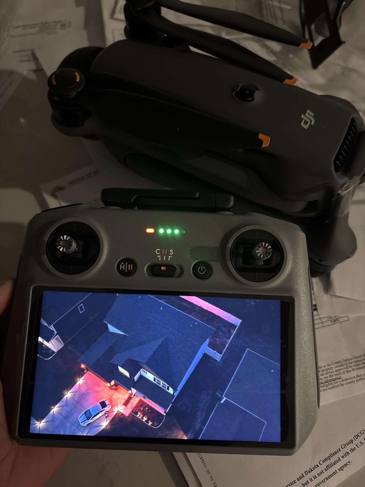
The X1 is the one I keep reaching for when a field is awkward. It weighs 249g, which keeps it under the threshold where recreational pilots must register the aircraft, and it still carries a 1/1.32-inch sensor behind a three-axis gimbal. That combination is rare: most sub-registered drones reach for electronic stabilization and a tiny sensor, and the picture suffers over a dense canopy.
Owners report that the extra range and the bright screen matter more than they expected. Flying a 9.32-mile link with a 1080p/60fps feed means you can start a survey at the field edge without walking the perimeter first, and the 5.5-inch 700-nit touchscreen is readable in direct sun on a July afternoon where a phone screen usually is not.
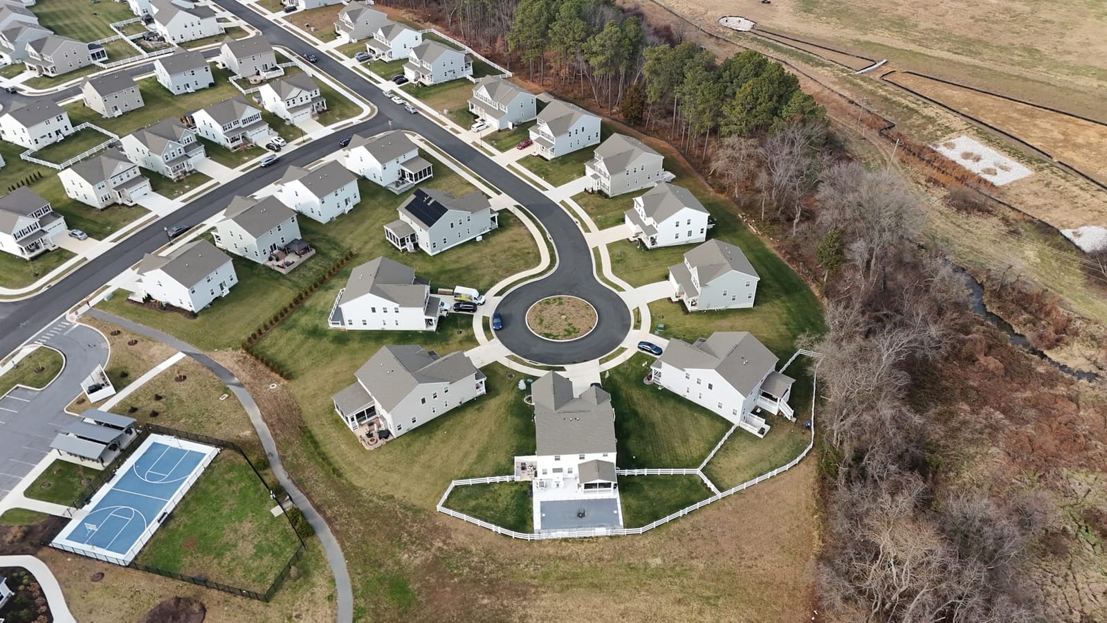
The specs back up the field experience. Flight time runs up to 96 minutes across three batteries, and the box includes a charging hub, three propeller pairs, a gimbal protector, and a shoulder bag. Slow-motion capture at 4K/100fps and a timelapse mode are there if you want them, though neither is what you will use most on cropland.
Tracking features are the reason farmers mention vertical shooting and dual tracking. AI Auto Track, Smart Spotlight and Dual Tracking all handle a moving subject, which covers livestock checks, equipment moving through a yard, and confirming whether a fence line breach is a hole or a downed post.
What the range and sensor mean for scouting work
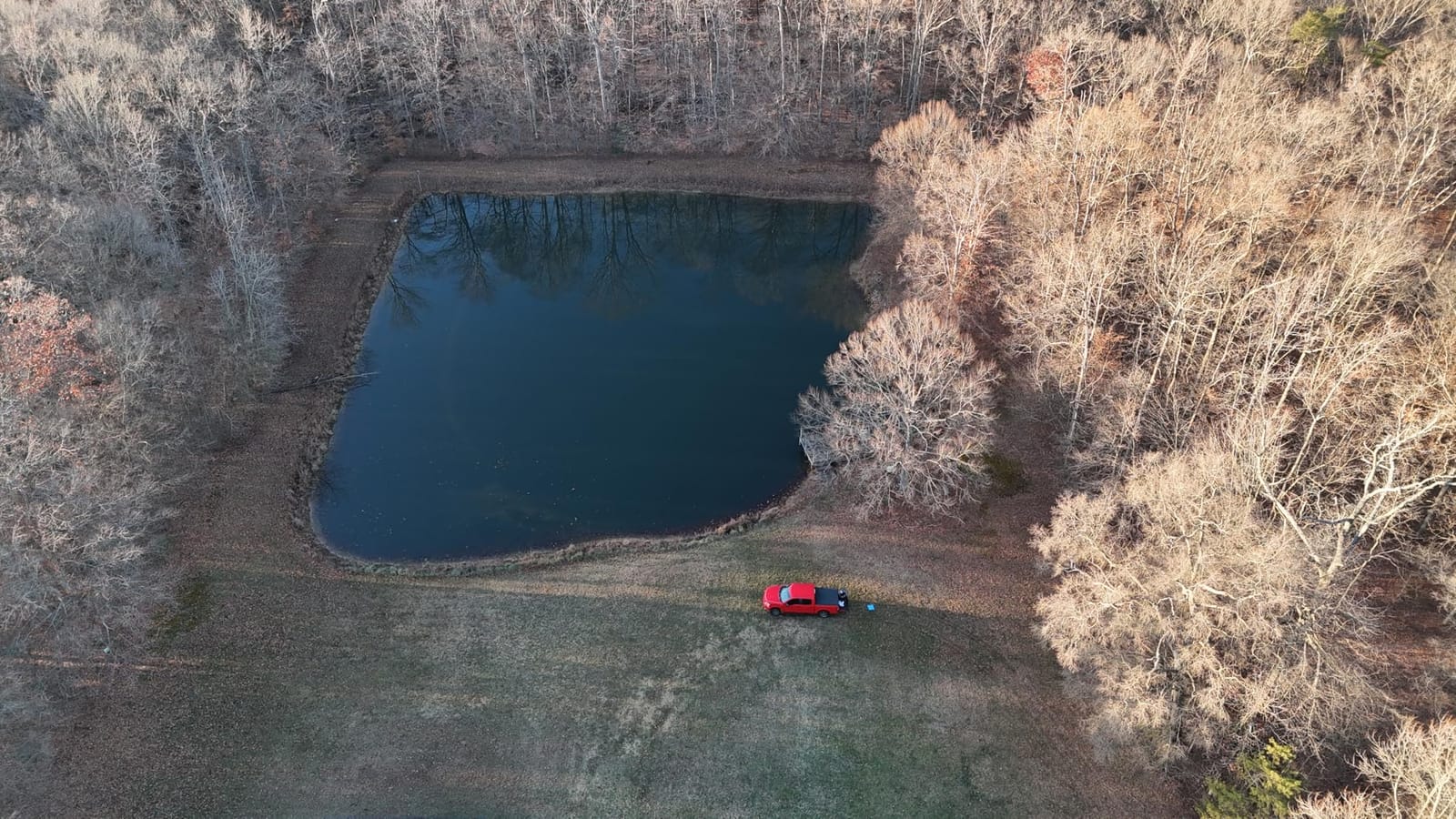
Nine miles of transmission is not the same as nine miles of legal flight. What it buys you is the ability to launch from a road or a barn and cover ground without relocating the aircraft mid-survey. For a field with a creek, a tree line, or a center pivot in the middle, that saves real time on every sortie.
The sensor is where the practical gain sits. A 48MP still from a 1/1.32-inch CMOS gives you enough pixel density to count rows, spot a stand loss from above, or zoom into a pivot leak without flying dangerously low. f/1.7 aperture helps under the flat grey light that follows a front moving through.
Where it falls short
The honest weakness here is the size of the owner base. With 300-odd reviews, there is less long-term data on gimbal and battery durability than the Potensic models carry. If you want a decade of parts history behind the brand, this is not that brand.
Interpolated still resolution is the other one. In some capture modes the 48MP figure is upscaled rather than read from the sensor at full resolution, so treat it as a marketing-adjacent number rather than a native detail budget. Video is unaffected.
2. DJI Air 3S: Best for Covering Large Acreage in One Sortie
DJI Air 3S (RC-N3), 4K Dual-Camera Drone
1in CMOS plus 3x tele camera
Forward LiDAR and omnidirectional sensing
45-min flight
20km transmission
Pros
- Dual cameras let you inspect canopy detail from a safe standoff distance
- 45-minute flight time and 20km transmission cover large tracts per sortie
- Forward LiDAR and omnidirectional obstacle sensing handle tree lines and structures
- Smart Return to Home lands close to the takeoff point
- Quieter in flight than the smaller Mini-series drones
Cons
- 724g sits well above the 249g no-registration threshold and must be registered
- RC-N3 package ships a single battery and no charger
- Bulky to carry to remote field edges
- 4K/30p files are heavily compressed
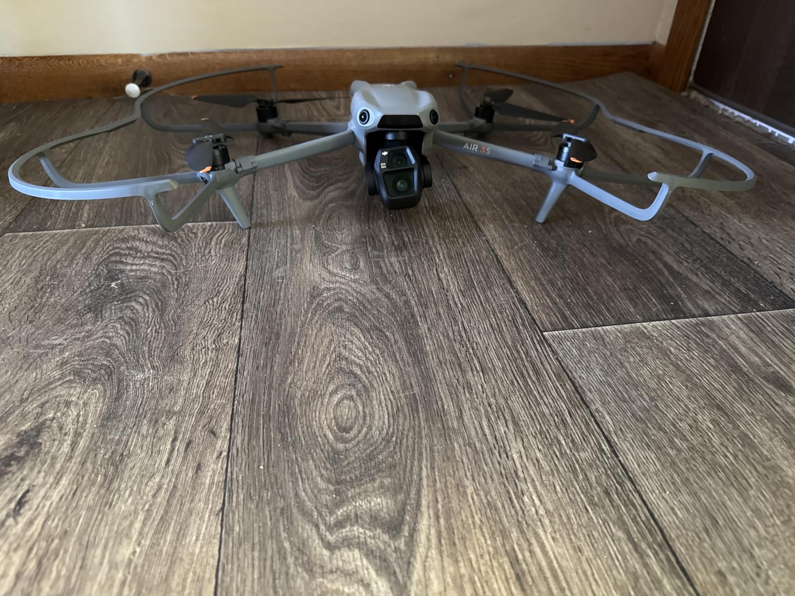
The Air 3S solves the specific problem of looking at one bad row from a safe height. The primary 1-inch CMOS wide camera pairs with a 3x medium tele, and that tele is the piece that changes how you scout. Instead of hovering a metre over the canopy and risking a gust that puts you in the corn, you frame the row from above and zoom in optically.
Obstacle sensing is the other reason it ranks this high on a farm. Forward-facing LiDAR plus omnidirectional sensors handle the two things that end most field flights badly: tree lines and grain legs. Owners also report the Smart Return to Home putting the aircraft down within about a quarter metre of where it launched, which matters when you are counting on the spot staying put for the rest of the season.
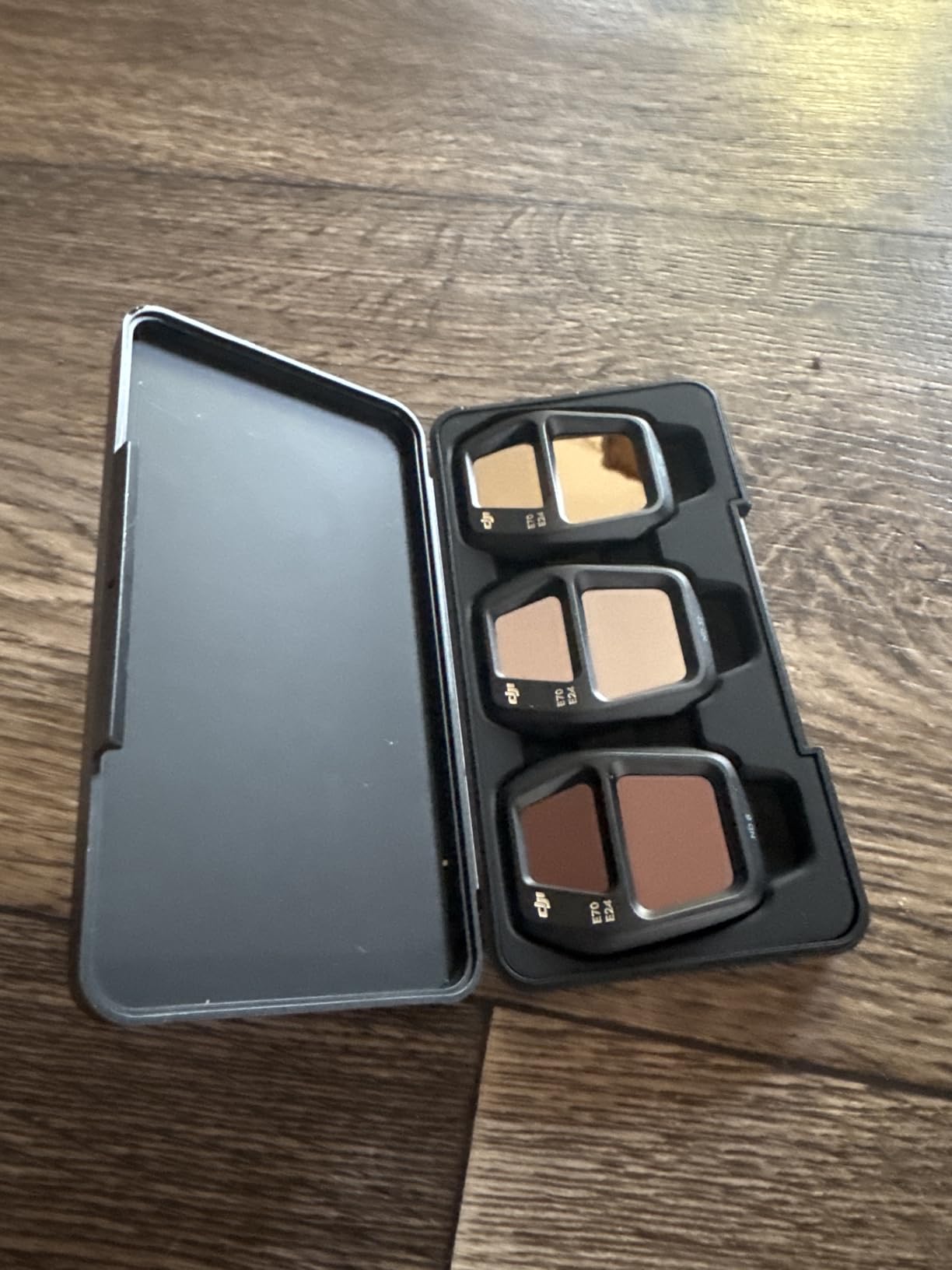
Endurance is the headline number at 45 minutes maximum, with 20km of video transmission behind it. Free Panorama mode stitches wide and tele frames together, which is useful for a quick look at a large block without flying a full grid. The RC-N3 controller uses a connected phone, so pack a charged battery and a sun-readable screen.
That single battery is the catch. The RC-N3 package ships one intelligent flight battery and no charger, so a genuine multi-battery survey means buying the extra packs and a charging solution separately. Budget for that before you commit, not after.
When the tele camera earns its weight
Low-flying detail work is where the Air 3S separates itself. Hovering at a metre or two over a canopy sounds efficient until the wind comes across an open field, and then image sharpness drops along with your confidence. Optical zoom from a stable hover fixes both problems at once.
It also cuts battery use. A 3x zoom lets you stand off further and spend less of the sortie climbing and descending, which on a 45-minute pack is a meaningful trade.
Registration and carry weight
At 724g the Air 3S is comfortably over the 249g threshold, so recreational and commercial operators both need to follow the applicable registration rules and Remote ID requirements. That is a paperwork cost, not a blocker, but it should be planned for.
The bulk is the other consideration. This is a full-size airframe that does not fold down to nothing, and owners note it is heavy to hike to a field edge with no road access. If your scouting ground is walk-in ground, the sub-249g options make more sense.
3. Potensic ATOM 4K: Best Value for Field Coverage Per Dollar Spent
Potensic ATOM 4K GPS Drone, 3-Axis Gimbal, 96 Mins Flight, 6KM Transmission
3-axis brushless gimbal
96 min on 3 batteries
6km PixSync 3.0 link
Visual tracking and QuickShots
Pros
- 3-axis mechanical gimbal keeps footage steady in level-5 wind
- 96 minutes of flight from three included batteries
- 6km transmission range covers large fields
- 64GB microSD card and parallel charging hub included
- GPS return-to-home with one-tap recall from the phone
Cons
- Heavier than the sub-249g ATOM SE once batteries are fitted
- About 32 minutes per battery means swaps on long surveys
- Visual tracking can be confused by low-contrast crop rows
Most of our field time goes into working out which drone covers the most ground per hour, and the ATOM 4K wins that contest on endurance. Three batteries and a 60W parallel charging hub give 96 minutes of total flight, and the hub refills the whole set in roughly 1.3 hours. That combination means one vehicle, one lunch break, one afternoon.
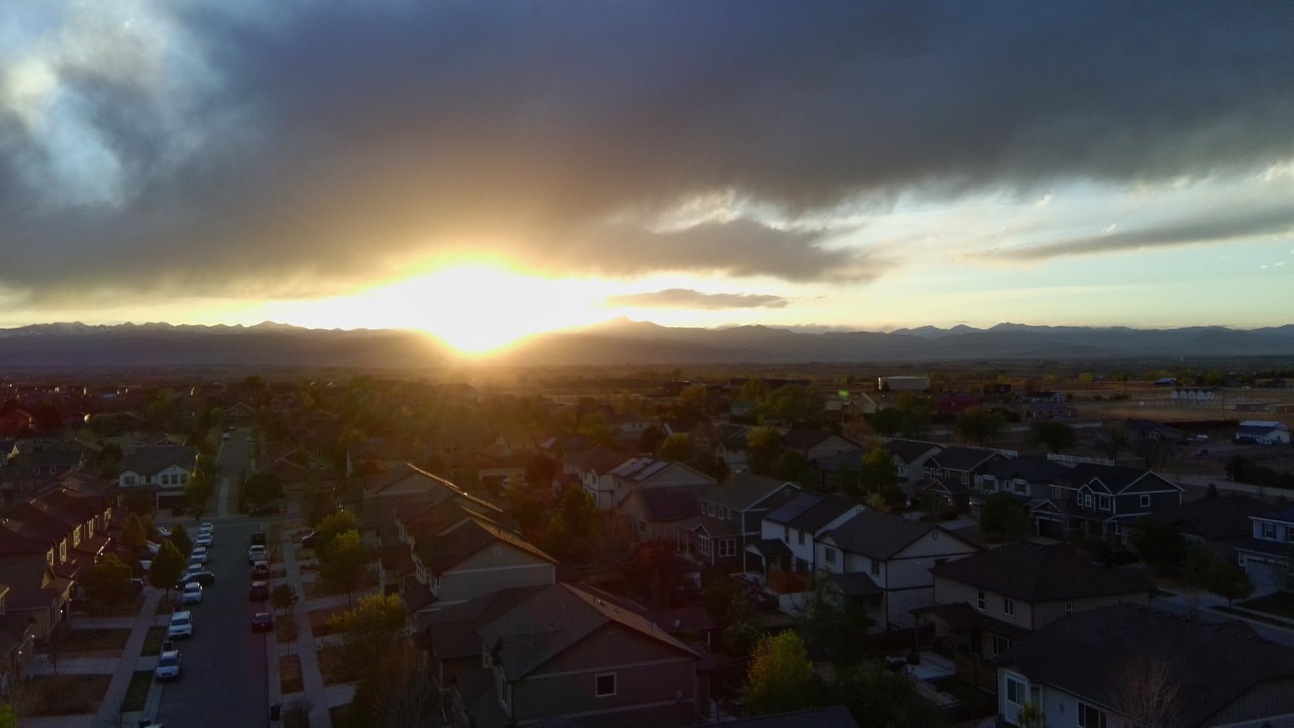
The 3-axis brushless gimbal is the feature that moved it above the cheaper tier for us. Owners specifically note it holds footage steady in level-5 wind, which is exactly the condition that softens detail on an open field. The sensor is a 12MP 1/3-inch Sony CMOS behind that gimbal, shooting 4K/30fps with up to 14 stops of dynamic range options.
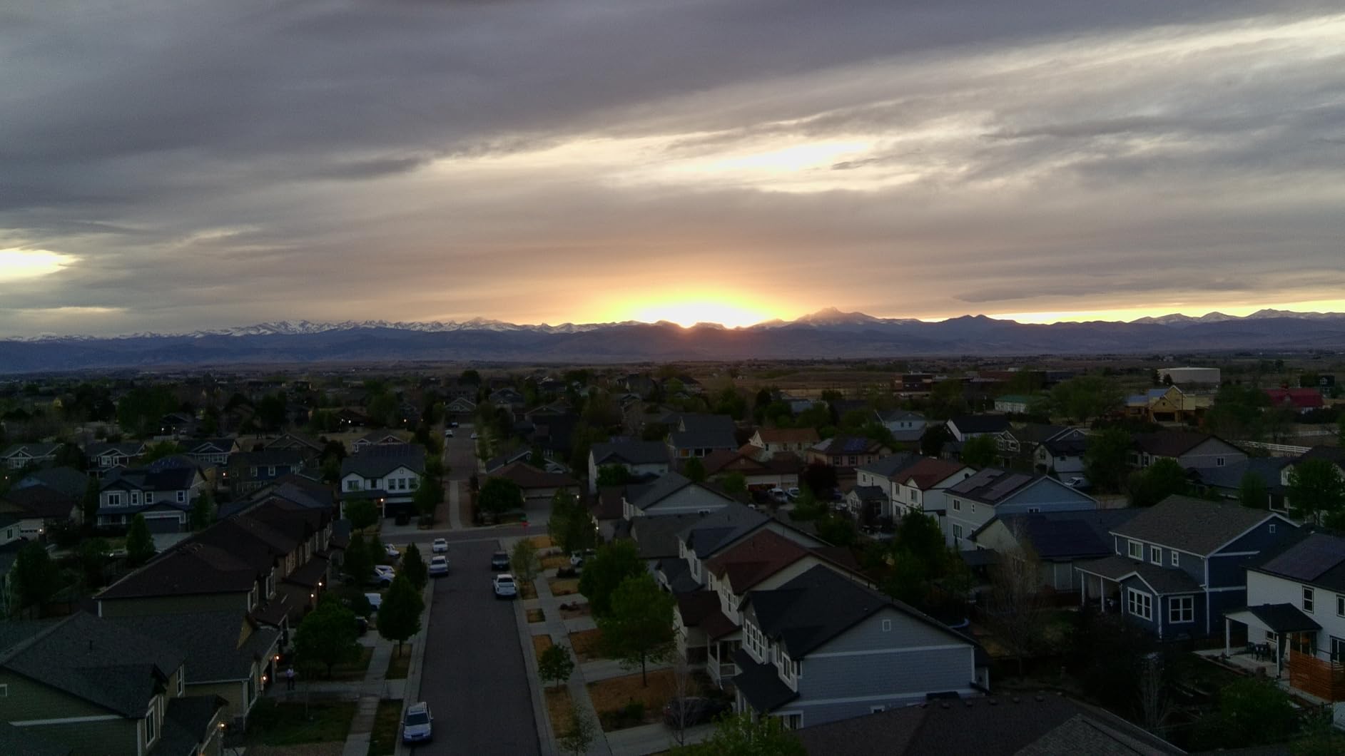
Range is 6km through PixSync 3.0 anti-interference transmission, and that link is generally holding up in the field for the acreage most operations are managing. Visual tracking and the QuickShots suite, including Pull-Away, Rocket, Circle, Spiral and Boomerang, let you automate a repeatable pass without hand-flying the whole line.
The box is unusually complete for this tier. You get a 64GB microSD card, three batteries, a parallel charging hub, eight spare propeller pairs, a camera protector and a screwdriver. None of that has to be ordered separately, which is where a lot of first-drone budgets quietly leak away.
Battery math for a real afternoon
Three batteries at roughly 32 minutes each is the number to plan around. Against a typical scouting sortie over a quarter-section, that works out to a full afternoon of coverage with a swap in the middle, which is the practical reason we keep this one on the truck rather than in the closet.
Note that the aircraft is heavier than the sub-249g model once the batteries are fitted, so do not assume the registration exemption carries over. Measure the loaded weight if that exemption matters to your operation.
Where it falls behind the premium tier
A 1/3-inch 12MP sensor is genuinely smaller than the 1-inch and 4/3-inch options here, and it shows when you zoom into a canopy edge or a damaged corner. If your work is mostly visual confirmation and stand checks, it is plenty. If you intend to build prescription maps from the imagery, look at a bigger sensor.
Visual tracking is the other soft spot. Low-contrast crop rows can throw it off, so run waypoint lines rather than tracks when you need the flight to come back identical every week.
4. DJI Mavic 3 Classic: Best for Repeatable Survey Routes
DJI Mavic 3 Classic (DJI RC), Drone with 4/3 CMOS Hasselblad Camera, 5.1K HD Video, 46 Mins Flight Time, Omnidirectional Obstacle Sensing, Smart Return to Home, FAA Remote ID Compliant
4/3 CMOS 20MP RAW capture
Waypoint Flight for repeatable routes
46 min flight,40 min hover
15km transmission
Pros
- Waypoint Flight repeats a route precisely through selected aerial points
- Advanced Return-to-Home syncs the return trajectory in real time
- 4/3 CMOS Hasselblad camera records RAW and 5.1K video
- Owners report 38-45 minutes of real flight per battery
- FAA Remote ID compliant out of the box
Cons
- Bundled DJI RC controller is reported as slow and laggy
- No vertical shooting capability
- Spare batteries cost extra and a separate case is needed
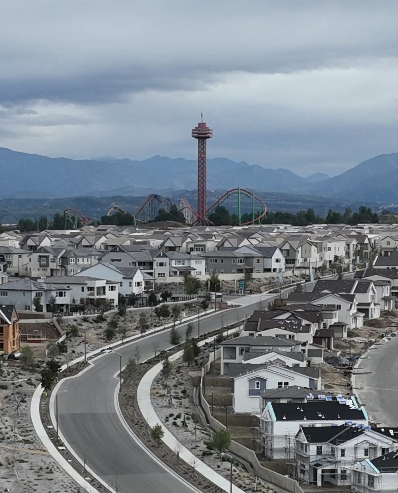
When your scouting has to be comparable month over month, the feature that matters is repeatability. Waypoint Flight on the Mavic 3 Classic flies through selected aerial points automatically, so the same field produces the same pass pattern every time you launch. Combined with Advanced Return-to-Home and AR RTH trajectory sync, that is the tightest repeat-survey loop in this roundup.
The camera is the 4/3 CMOS Hasselblad L2D-20c at 20MP, and it captures RAW DNG alongside 5.1K video. RAW matters more than it does for photography because it gives processing software real headroom when you are correcting uneven light across a large field or exposing a shaded headland.
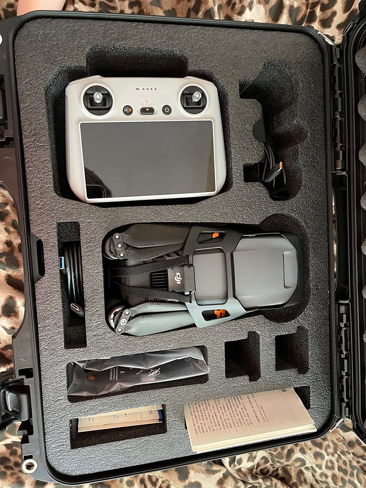
Endurance is quoted at 46 minutes of flight and 40 minutes of hovering on Mavic 3-series batteries, and owners report real numbers landing around 38 to 45 minutes. Transmission runs 15km with a 1080p/60fps feed. Omnidirectional obstacle sensing with APAS 5.0 handles the approach and the return without much input from you.
At 895g it is light for a drone in this class, and owners mention carrying it around without much strain. The 5.5-inch HD display on the DJI RC has DJI Fly pre-installed, so there is no phone in the loop. Remote ID compliance is built in, which saves a step before commercial work.
Why RAW and waypoint beats a bigger screen
Photogrammetry software rewards a consistent camera at a consistent position. Fly the same line, keep the same altitude, shoot RAW, and the resulting point cloud is directly comparable to last month’s. Skip any of those and you are re-baselining the field every survey.
That is also why we would choose this over a drone with a better display. The screen is a convenience; the repeatable route is a data asset.
What owners complain about
The bundled controller draws the most criticism. It is reported as slow and laggy with limited third-party app support, which is annoying when you are trying to trigger a survey from the field edge. Voice-control apps that run on a phone are the usual workaround, but they need the phone charged.
There is also no vertical shooting capability, and sport mode disables the omnidirectional sensors, so a fast pass across a yard is flown without the safety net. If you need to work close to livestock or structures, leave sport mode off.
5. Autel EVO 2 Pro V3: Best for Canopy Detail in Variable Light
Autel Robotics EVO 2 Pro V3 w/Son-y 1″ CMOS Sensor & 6K HDR Video
Sony 1in 20MP with 6K video
F2.8-F11 adjustable aperture
12-bit DNG stills
40 min flight,15km link
Pros
- Adjustable F2.8-F11 aperture handles changing light over a single flight
- 6K video and 20MP RAW from a Sony 1-inch sensor
- 12-bit DNG and a 12-bit color pipeline give processing software real headroom
- No geo-fencing
- so the aircraft alerts instead of blocking your flight
- Bundle includes two batteries
- a 32GB SD card and a hard case
Cons
- Sticks feel more sensitive than DJI controls when switching brands
- Fewer smart flight modes than DJI alternatives
- Obstacle avoidance sensitivity is not adjustable and can halt slow flight
The adjustable aperture is the reason this drone keeps showing up in agronomy circles. Scouting flights start at 8am and end by mid-afternoon, and a fixed-aperture camera forces you to either overexpose the shaded rows or lose the highlights. The F2.8-F11 range here lets you re-expose without changing shutter speed or ISO on every pass.
That discussion has a long history on DJI community forums, where pilots upgrading from older Mavics consistently asked for exactly this feature. The EVO 2 Pro V3 answers it with a Sony 1-inch 20MP sensor, max ISO 44000, Moonlight Algorithm 2.0, and 12-bit DNG stills recorded through a 12-bit color pipeline.
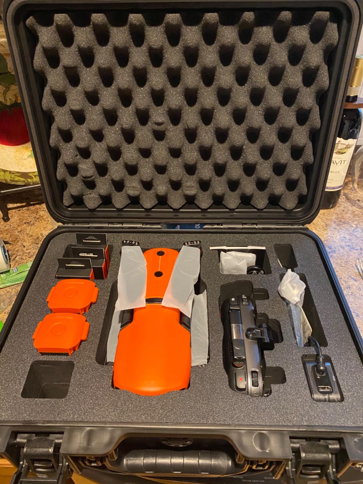
The SkyLink 2.0 link runs to 15km on tri-band 2.4GHz, 5.8GHz and 900MHz with automatic frequency hopping, and the 7100mAh battery gives up to 40 minutes of forward flight or 35 minutes hovering. The 6.4-inch Smart Controller SE has an OLED touchscreen, an 8-core processor and an IP43 rating, which matters when the survey happens in actual weather.
There is no geo-fencing in no-fly zones. The aircraft alerts you and it is the pilot’s job to know the local rules. For farmland near a controlled airport that is occasionally a feature, since you are not fighting the firmware.
What geo-fencing does to a farm pilot
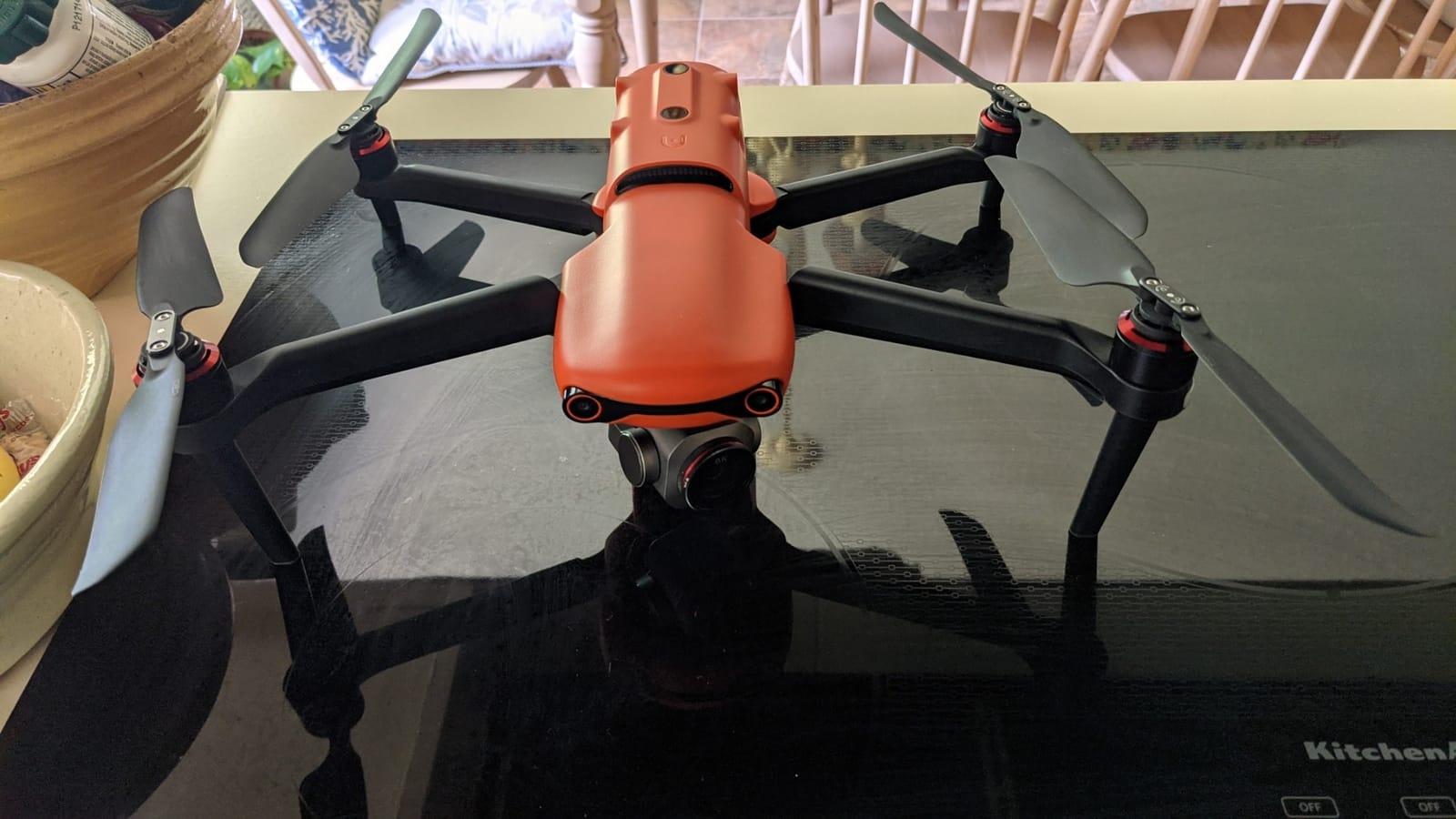
Some farm ground sits close enough to an airport that geo-fenced drones will refuse to launch or cut out mid-flight. Owners report the alert-only behavior here works well, though it shifts responsibility onto you. Know your local airspace before you rely on it.
That flexibility pairs with Dynamic Track 2.0, which models a target and tracks up to 64 objects at once. Useful for a herd moving along a fence, useless for a static stand count.
Learning curve and storage habits
Controls feel more sensitive and twitchy than DJI sticks, particularly for pilots moving over from another brand. Budget a few flights to adapt before you take it over a field you care about.
Owners also report batteries losing roughly half their charge sitting unused in the case for about a week. That is not a defect, but it means you charge the night before a survey, not the night before the day before.
6. Autel EVO II Dual 640T V3: Best for Thermal Scans of Irrigation and Livestock
Autel Robotics EVO II Dual 640T V3, 640×512 Thermal Imaging Drone, RemoteID
640x512 thermal at 30fps
50MP 0.8in RYYB visible camera
D-RI ranges and 10+ palettes
38 min flight
Pros
- 640x512 thermal sensor with 13mm lens
- 16x zoom and 100m subject recognition
- D-RI ranges plus 10 or more thermal palettes for isolating heat signatures
- Picture-in-picture overlay puts the thermal frame beside the visible image
- Three batteries
- multi-charger and car charger included
- 360-degree obstacle avoidance from a 19-sensor suite
Cons
- Some buyers report thermal camera failure within a year
- Warranty service has been reported as difficult to obtain
- Does not support Autel's modular accessory attachments
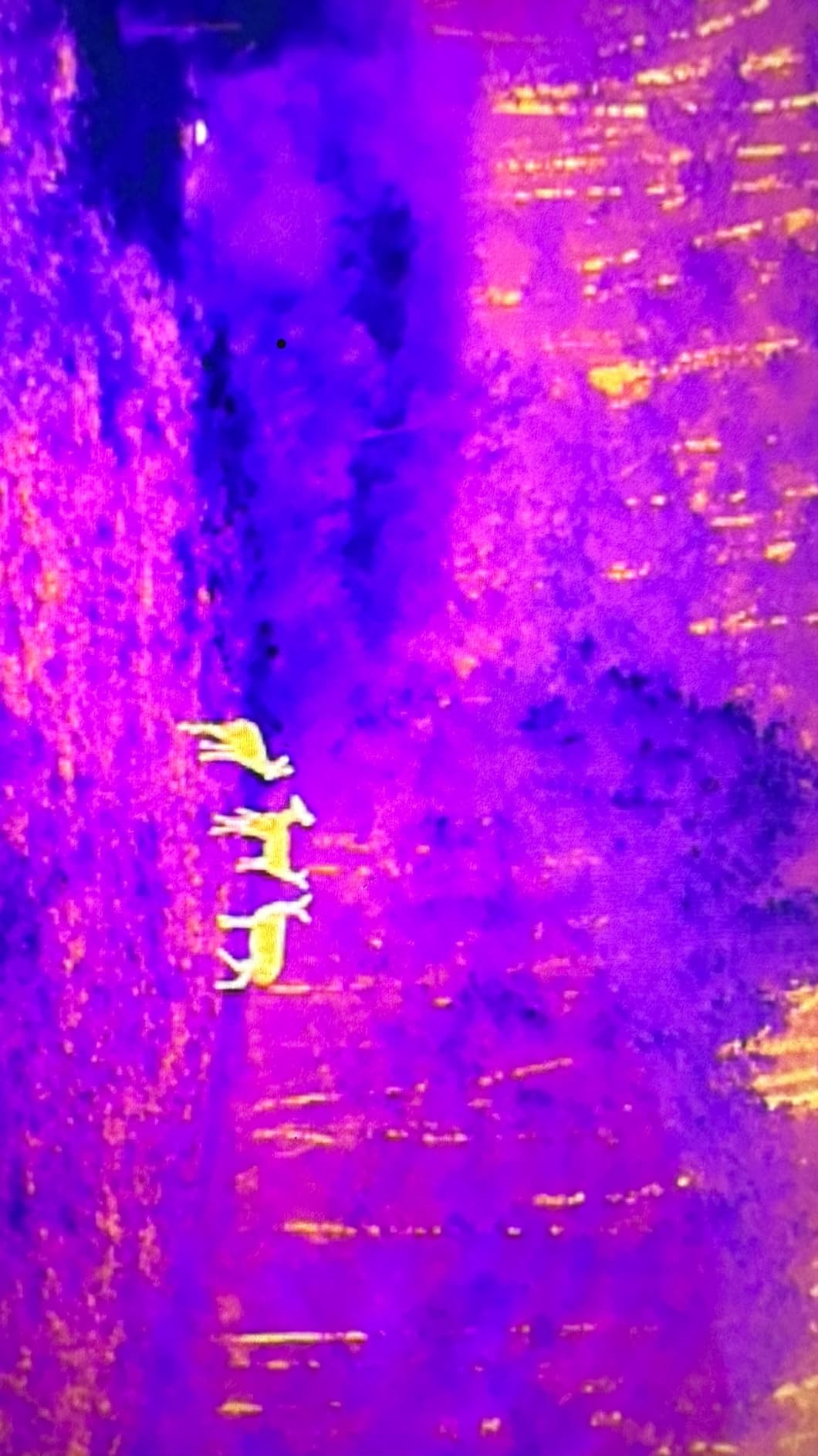
This is the only drone here with a genuine thermal payload, and that changes what a scouting flight is for. A 640×512 thermal sensor at 30fps with a 13mm lens and 16x digital zoom picks up temperature differences that no RGB camera can see. On an irrigation main it will show you where a leak is cooling the soil, and at dusk it will separate a sick animal from a healthy one in a pasture.
The D-RI ranges, meaning detection, recognition and identification distances, give you a defined scale to work against instead of guessing from a color gradient. Add 10 or more thermal palettes, central, spot and regional temperature measurement, picture-in-picture, isotherm and a temperature alarm, and you have a survey tool rather than a novelty.
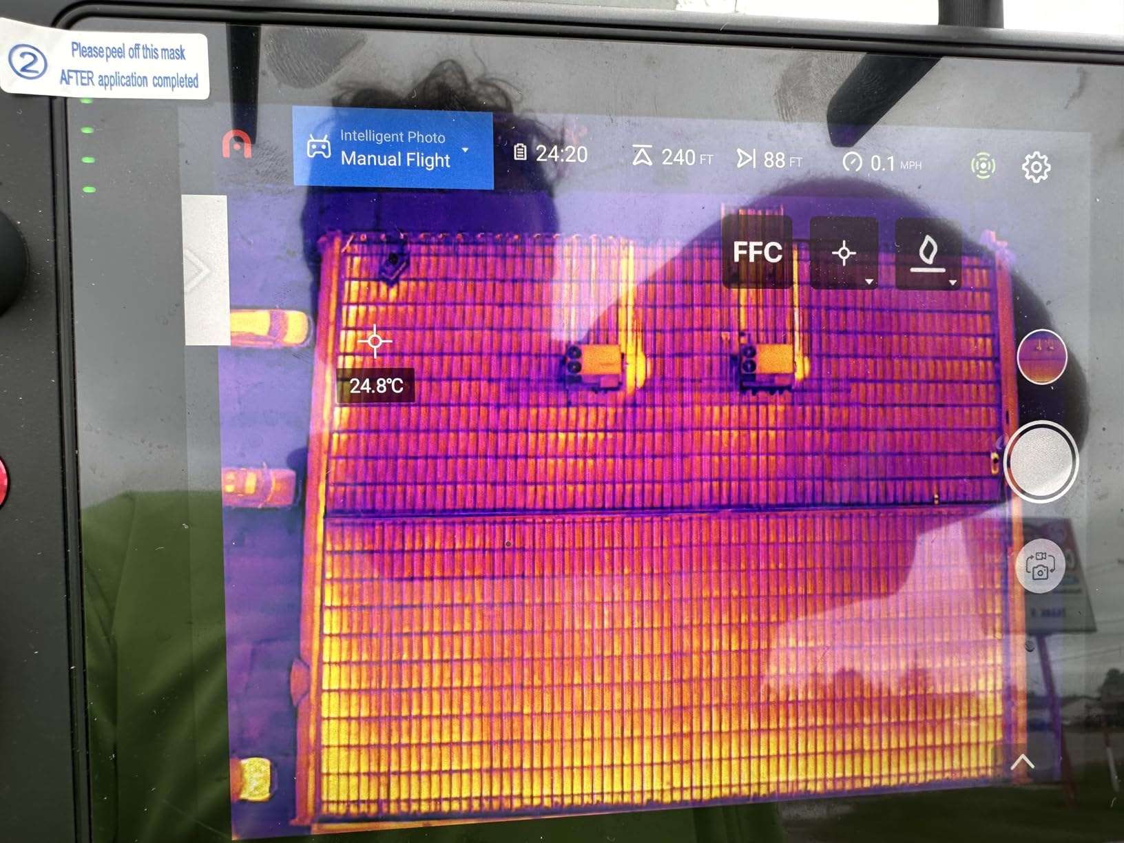
The visible side is not an afterthought. A 50MP 0.8-inch RYYB CMOS with 4x lossless and 16x digital zoom gives you the color context you need to know whether that warm patch is a weed, a dry stand, or a leak. Flight time is 38 minutes and the SkyLink 2.0 link runs to 15km at up to 2.7K across three bands.
The box is unusually generous for a thermal platform. Three batteries, a multi-charger, a car charger, spare control sticks, a protective case and the 4.7-inch Smart Controller V3 are all included, which sets it up for a full day away from a truck outlet.
Where thermal genuinely beats RGB
Irrigation is the clearest case. A leaking or blocked lateral changes soil temperature before anything changes visually, and a thermal pass over a pivot in the early morning will find it while a color camera still shows healthy green.
Livestock and wildlife work is the second. Herd counting and thermal-assisted location in low light is straightforward with a 100m recognition range, and the picture-in-picture layout means you keep visual reference instead of flying blind on a monochrome frame.
The reliability question
This is the product in the roundup with the thinnest rating and the smallest review pool, and the reason is worth taking seriously. Some buyers report thermal camera failure within a year, and customer-reported difficulty getting warranty service shows up more than once, including a unit where water damage was claimed and a repair declined.
Thermal payloads are expensive repairs. If you are leaning on this aircraft for paid work, treat the support situation as part of the purchase decision rather than a detail you find out about later.
7. DJI Mavic 4 Pro: Best for Low-Light and Dusk Surveys
DJI Mavic 4 Pro Drone With DJI RC 2, Flagship Tri-Camera Drone
100MP 4/3 CMOS Hasselblad camera
0.1-Lux omnidirectional night sensing
51-min flight
30km O4+ transmission
Pros
- 100MP 4/3 CMOS Hasselblad main camera with 6K/60fps HDR video
- 0.1-Lux Nightscape omnidirectional obstacle sensing supports night flights
- 51 minutes maximum flight time
- Airframe stays stable in gusty open-field conditions
- Omnidirectional sensing makes crashes unlikely in normal use
Cons
- Gimbal is described as fragile and easily damaged by minor bumps
- Service and repair costs are reported as high
- Actual battery endurance reported closer to 30 minutes in some use
- Real-world controller range falls short of the advertised figure
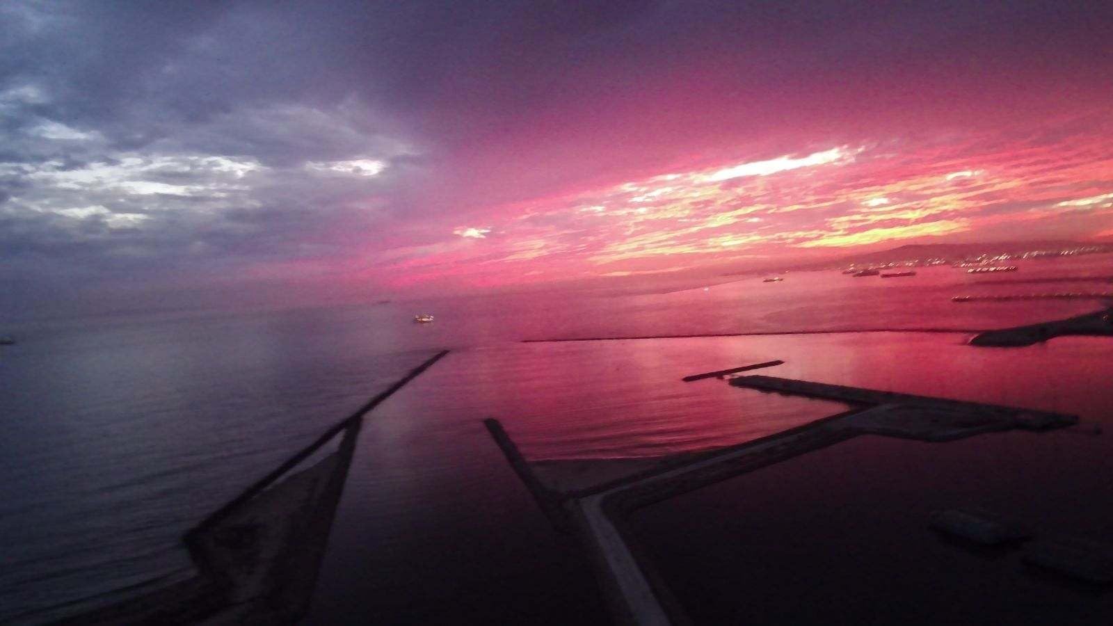
Flat evening light is the hardest condition for canopy scouting and this aircraft handles it best. The 100MP 4/3 CMOS Hasselblad main camera shoots 6K/60fps HDR, and paired with 0.1-Lux Nightscape omnidirectional obstacle sensing it is the only drone here that is genuinely comfortable flying after sunset, when livestock settle and irrigation problems are easiest to spot.
Dual tele cameras on 1/1.3-inch and 1/1.5-inch CMOS sensors handle the zoomed work, and the Infinity Gimbal rotates 360 degrees so the camera can follow a subject without the aircraft having to circle it. Endurance is the best figure in the roundup at 51 minutes maximum, with O4+ transmission quoted at 30km with a 10-bit HDR video feed.
Owners describe the aircraft as stable in wind, with the airframe barely moving in gusty conditions, and note that releasing the sticks produces an immediate hover. That is a beginner-friendly trait and a real safety benefit when you are working a field edge with a fence on one side.
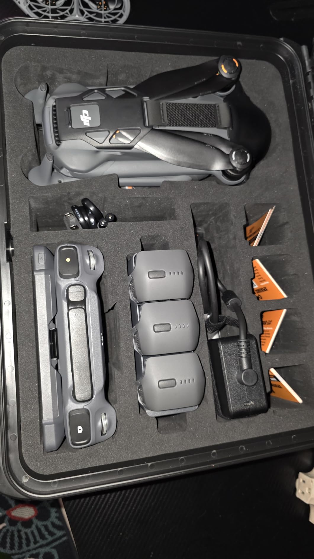
It is also a heavy aircraft at 2372g. This is not a pack-and-go drone for walking into a back field; it is a truck-bed drone that flies from where the vehicle can reach.
Spec sheet versus field reality
Advertised numbers and flown numbers are not the same thing, and this is the airframe where the gap shows. Some buyers report actual battery endurance closer to 30 minutes rather than the published figure, and real-world controller range falling short of 30km once there are trees or a grain leg in the way.
Plan your acreage math on the conservative number, not the headline. Half the published endurance still leaves a workable sortie; discovering the gap after you have committed a two-hour window is what hurts.
Handling and support
The gimbal is the most repeated complaint. Owners describe it as extremely fragile and easily damaged by minor bumps, so treat the gimbal protector as mandatory kit and avoid setting the aircraft on its side in the bed of a truck.
Service is the second theme. Buyers report DJI service plans being unavailable in the US with repairs quoted above a thousand dollars, and the DJI Fly app having to be downloaded from the DJI website rather than installed through Google Play. Plan for both if this is a working tool rather than a weekend toy.
8. Potensic ATOM SE: Budget Pick for Starting Out
Potensic ATOM SE GPS Drone with 4K EIS Camera, Under 249g, 62 Mins Flight, 4KM FPV Transmission, Brushless Motor, Max Speed 16m/s, Auto Return, Lightweight and Foldable Drone for Adults Beginner
4K EIS camera with 1/3in CMOS
62 min on 2 batteries
4km PixSync 2.0 link
8.8 oz under 249g
Pros
- Under 249g so recreational pilots need no FAA registration
- 62 minutes of total flight from two included batteries
- 4km FPV transmission suits scouting larger fields
- GPS auto return with Follow Me
- Waypoint Flight and Circle flight modes
- Folds down small enough to live in a truck console
Cons
- Camera uses electronic stabilization rather than a mechanical gimbal
- 12MP still resolution is below larger-sensor competitors
- Micro SD card is not included
The ATOM SE is the cheapest way to find out whether drone scouting works on your ground at all, and its 6.7k+ owner reviews make it the most thoroughly tested aircraft here. At 8.8 ounces it folds into a handbag, launches without registration for recreational pilots, and carries two batteries giving 62 minutes of combined flight.
It handles wind better than its weight suggests. Owners of the sub-registered category report level-5 wind performance that surprises people, and on r/AgriculturalDrones that class of drone comes up repeatedly as a capable first step for operations that are not ready to commit to a registered platform.
The feature set covers the scouting essentials: GPS auto return, Follow Me, Waypoint Flight and Circle Flight, plus FOTA firmware updates and brushless motors. PixSync 2.0 transmission reaches 4km, which is enough to work a large field from one launch point.
The camera is where it gives ground. A 1/3-inch CMOS sensor with ShakeVanish electronic image stabilization produces 4K/30fps video and 12MP stills with a 118-degree field of view. Electronic stabilization smooths video well but cannot hold a crisp still of a canopy the way a mechanical gimbal can.
What a first season of scouting really needs
If your plan is confirmation scouting, checking irrigation and fences, and confirming where a problem is before you drive out to it, this is enough. Wide-angle context, a stable feed, a reliable return home, and two batteries is the whole job.
The 4km link and waypoint modes also mean you can start building the repeatable-survey habit now, which is the habit that pays off later when you upgrade to a bigger sensor.
Where you will outgrow it
Twelve megapixels is the ceiling. Zooming into a stand loss, a weed patch, or a pivot leak from 300 feet will produce soft images, and there is no mechanical gimbal to recover the detail. If your scouting turns into mapping, you will replace this within a season or two.
Also budget for a micro SD card, which is not included. It is a small thing that stops a first flight before it starts.
How We Picked These Drones?
We ranked these aircraft on the things that change results during a scouting season, not on spec sheet length. Flight time per battery and the number of batteries in the box set the acreage you can cover in an afternoon. Sensor size and stabilization decide whether you can answer a question from the air or have to walk the row.
Transmission behavior over open ground matters more than the headline range figure, because a farm field has no line of sight to the horizon in every direction. Obstacle sensing was judged against farm-specific obstacles: grain legs, pivot towers, tree lines, power lines and livestock. And we weighted the complaint themes that recur across owner reviews, including support access, spare battery cost, and how the aircraft behaves when stored in a hot truck for a week.
Every rating and review count in this roundup comes straight from the current owner feedback on the product page. We did not exclude any aircraft for brand, and the lineup spans sub-registered toy-weight drones through a thermal-equipped enterprise airframe, because that spread matches how different farms actually scout.
How to Choose a Drone for Crop Scouting?
1. Flight time and the battery math
Choose on minutes per battery, not on the total quoted across a bundle. A 40-minute battery and a 30-minute battery with two of each cover the same ground, but the second option lets you fly shorter, tighter sorties and keep more reserve for the return leg. Count your batteries, multiply by realistic per-battery minutes, then divide by your line speed to know how many acres a single afternoon covers.
Then add the charging story. A parallel hub that refills the full set while you fly the previous set is worth more than an extra battery in most cases. If the aircraft ships without a charger, that is a line item you need to plan for.
2. Sensor size and stabilization
Sensor size is the number that decides whether aerial scouting is a real replacement for walking. A 1/3-inch sensor gives you context and confirmation. A 1-inch or 4/3-inch sensor gives you usable detail at 200 feet, which is where stand counts, weed patches and pivot problems start to become readable from the aircraft.
A mechanical gimbal matters as much as resolution for stills. Electronic stabilization smooths video beautifully but leaves still images soft. If you plan to process imagery, insist on the gimbal. If you only need to spot and confirm, electronic stabilization is acceptable.
3. Range and real-world signal
Transmission range tells you how far you can fly before losing the video feed, and what matters is the worst case rather than the best. Tree lines, a center pivot, a grain leg and a farmhouse block signal in ways that a clear number never predicts. Treat the published figure as the ceiling and confirm the aircraft holds control at the distance your ground actually requires.
4. Weight class and FAA obligations
The 1:1 rule applies to everyone. You must maintain unaided visual line of sight to the aircraft at all times, which means a drone parked on the far edge of a 160-acre field with a tree line between you and it is not legal, however good the transmission is.
Weight drives registration. Aircraft at or under 249g are exempt from registration for recreational flight only. Anything heavier must be registered, and commercial work requires a Part 107 certificated remote pilot regardless of weight. Remote ID compliance matters once you are operating for hire. Know which side of each line you are on before you buy, because it changes what you can legally do with the aircraft you chose.
5. Obstacle avoidance and failsafes
Buy the most complete sensing package your budget allows. Omnidirectional sensing plus forward LiDAR is what lets you fly a fence line at low altitude without constant manual correction. Return-to-home quality is equally important, and owners consistently rate accuracy by how close it lands to the original takeoff point, because that spot becomes your baseline for every survey after it.
6. Software and the mapping workflow
Decide what you do with the images before you pick the aircraft. Pure visual scouting works in the manufacturer’s own app. Building orthomosaics, comparing layers over time, or exporting prescription maps means a processing platform, and those have their own costs and their own compatibility lists. Check that your intended software reads the files your drone actually produces before you commit.
Two terms worth knowing. GSD, or ground sample distance, is how many centimeters one image pixel covers on the ground, and it sets your minimum detectable feature size. RTK positioning is centimeter-level correction that makes a return visit to the same point land in the same place, which is what makes season-over-season comparison trustworthy.
Crop-Specific Scouting Workflows
The right way to fly depends on what is growing, and the eight drones above cover every row crop and specialty block that most farms run. Here is how we would approach each.
Corn
Corn is the hardest canopy to read from the air because the plants stand tall and the rows create their own shadows at midday. Fly earlier in the morning or later in the afternoon so low sun picks out the row structure instead of flattening it. The tele cameras on the DJI Air 3S earn their place here, letting you frame a suspect row from 100 feet without descending into turbulent air near the canopy.
What you are looking for is missing stands, lodged plants after a storm, and drainage-related color shifts. Keep the flight at a consistent altitude so next week’s pass is directly comparable, and hold the pattern to fixed GPS points rather than free flight.
Soybeans and wheat
These are easier because the canopy is low and closed. A single wide pass at a constant height gives you a clean picture of stand density and any area where the canopy has thinned. The lower-cost drones here, including both Potensic models, handle this work well because you do not need much optical resolution to spot a bare patch.
Wheat adds a maturity question that color photography answers only partially. Ripening shows as a yellowing gradient, but disease can look similar at a distance, so treat a suspect patch as a prompt to walk it rather than a diagnosis.
Vineyards, orchards and specialty crops
High-value crops reward the higher-resolution sensors. A 4/3-inch or 1-inch camera flying a slow pass down the row can resolve individual canopy gaps, leaf damage and irrigation emitter problems. This is the case where the Mavic 4 Pro’s 100MP sensor and the Autel EVO 2 Pro V3’s aperture control genuinely earn their cost.
Orchards also expose a limit of RGB imaging. Trunk damage, canopy density and water stress all register, but early disease detection usually needs multispectral bands rather than color. If that is the goal, the scouting drones here are a starting point, not a destination.
Livestock, irrigation and infrastructure
For herd counts and fence line work, endurance matters more than sensor size, which puts the three-battery drones in front. The SkyBridge link and 6km PixSync links let you work a large pasture from one launch point, and tracking modes help when animals are moving.
For irrigation and livestock temperature work, the thermal payload is the deciding factor. Flight irrigation mains in the early morning before solar heating masks the differential, and the Autel thermal airframe with D-RI ranges gives you a defensible number rather than a guess from a color gradient. Thermal also handles dusk scouting, when a sick animal separates cleanly from a healthy herd in the frame.
Our broader hunting and wildlife scouting roundup covers the night-flying side of the same decision if that is where your flights are heading.
Scouting Drone or Spraying Drone?
A scouting drone looks at your crop. A spraying drone carries a tank and applies product to it. They are different machines with different rules, different payloads and different price bands, and most of the confusion comes from search results that mix them together.
Spraying platforms in the 50L class carry a full chemical load and are typically quoted in the five-figure range once the airframe, batteries and support are counted. They fall under a heavier regulatory regime for chemical application and require dedicated training. Nothing in this roundup sprays, and no software upgrade will change that.
If your goal is finding problems before they cost you yield, start with an imaging drone like the ones above. Multispectral platforms, which add near-infrared and red-edge bands for NDVI and vegetation index analysis, sit between the two categories: they still only look, but they can flag stress weeks before it shows in a color image. Pilots on r/UAVmapping and r/AgDrones regularly report catching disease and water stress early from multispectral passes, which is where that extra spend starts to pay for itself.
Related reading if your work is more general: our roundup of best crop sensor cameras covers the ground-based alternative, and bale spears covers the other tool that saves a lot of walking during harvest.
Frequently Asked Questions
What is the best drone for agriculture?
For visual crop scouting, the DJI Air 3S leads this roundup because its 1-inch wide camera and 3x tele camera let you inspect canopy detail from a safe standoff, backed by forward LiDAR and 360-degree sensing for grain legs and tree lines. The SKYROVER X1 is the pick if you want to stay under the 249g registration threshold, and the Autel EVO II Dual 640T V3 is the one for irrigation and livestock work because it is the only airframe here with a thermal payload.
What is the best drone for scouting fields?
A drone with a mechanical gimbal, a 1-inch or larger sensor, and at least two batteries is the right tool for scouting fields. The SKYROVER X1 pairs a 1/1.32-inch sensor with a 3-axis gimbal and stays under 249g, while the DJI Air 3S adds an optical tele camera for detail work and 45 minutes of flight. Both fly repeatable lines, which is what makes season-over-season comparison work.
How to decide which drone to buy?
Work through five questions. How many acres per sortie, which determines your flight time and battery count. How small a feature must you see, which sets the sensor size and whether you need a mechanical gimbal. What is in your line of sight, which decides how much obstacle sensing you need. Are you flying recreationally or for hire, which sets registration and Part 107 requirements. And what will you do with the images, which decides your software budget.
What is the 1:1 rule for drones?
The 1:1 rule means you must maintain unaided visual line of sight to your aircraft at all times. You cannot fly a drone to the far corner of a large field and watch it on a controller screen alone. Even drones with 15 or 30km of transmission range are limited by this rule, and it applies to both recreational and commercial operators.
Do you need a multispectral drone for crop scouting?
No, not to start. An RGB camera with a mechanical gimbal handles stand counts, irrigation checks, storm damage and fence line work, which is most of what a scouting pass does. Multispectral sensors add near-infrared and red-edge bands so you can compute NDVI and spot water or nutrient stress before it is visible, and they pay off once you are managing large acreage or building variable rate prescriptions.
Which multispectral drone is the best?
None of the eight drones in this roundup carry a multispectral sensor, so we do not rank them here. This list is imaging platforms for visual scouting. If you need NDVI and vegetation index data, look at purpose-built multispectral platforms from the precision agriculture side of the market and budget for the processing software that comes with them.
What are some good drones for farm use?
The SKYROVER X1 for long range under 249g, the DJI Air 3S for large acreage with tele detail, the DJI Mavic 3 Classic for repeatable survey routes, the Autel EVO 2 Pro V3 for adjustable aperture in variable light, and the Autel EVO II Dual 640T V3 for thermal irrigation and livestock work. The Potensic ATOM 4K and ATOM SE cover budget operations that want long battery totals and simple flight modes.
How much does a crop spraying drone cost?
Spraying drones with a 50L class payload are quoted in the five-figure range once the airframe, batteries and support are included, and they carry the heaviest regulatory requirements of any agricultural drone. That is a different purchase from anything in this roundup, which covers imaging drones only. If you are still deciding which category you need, start with scouting and upgrade later.
Final Verdict for Farm Crop Scouting
The SKYROVER X1 is our pick for the best drones for farm crop scouting in 2026 because it is the only aircraft here that combines a 1-inch-class sensor, a mechanical gimbal, a 9.32-mile link and a 700-nit screen controller while staying under 249g. That combination is what you want from a scouting aircraft: real detail, no phone in the cold, and no registration paperwork to sort out on a Saturday morning.
Buy the DJI Air 3S if acreage is the problem, the Potensic ATOM 4K if budget is, the Mavic 3 Classic if you need identical survey lines every week, and the Autel EVO II Dual 640T V3 if irrigation and livestock are the actual job. Whichever you choose, fly repeatable routes, keep spare batteries in the truck, and use the buttons above to compare the current lineup for your operation.


