

Best Waterproof GPS Units for Kayak Navigation in 2026
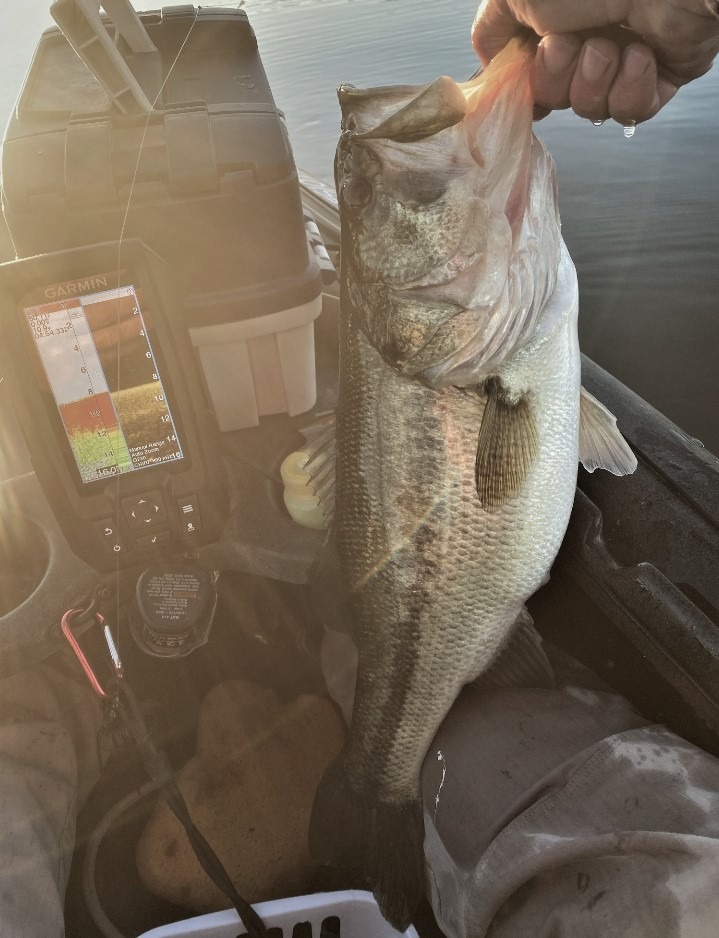
Last summer, I found myself paddling through unfamiliar coastal waters when thick fog rolled in unexpectedly. My phone, tucked inside a waterproof case, was useless with wet fingers and poor visibility. That day taught me why a dedicated waterproof GPS unit isn’t just nice to have for kayaking, it’s essential safety gear.
If you’ve ever tried using your smartphone for kayak navigation, you know the struggle. Touchscreens don’t respond to wet fingers. Screens become unreadable in bright sunlight. Battery life drains faster than you’d expect. And most importantly, cell signals disappear the moment you venture offshore. A proper handheld marine GPS solves all these problems while giving you reliable waypoint marking, route tracking, and emergency features.
In this guide, I’ve tested and compared the best waterproof GPS units specifically for kayak navigation in 2026. Whether you’re a sea kayaker navigating open water, a kayak angler marking fishing spots, or a recreational paddler exploring new waters, you’ll find the right unit here. I’ll cover what actually matters on the water, from IPX7 ratings to screen visibility to mounting options that actually work on kayaks.
Quick Overview: Top 10 Waterproof GPS Units
| Product | Specs | Action |
|---|---|---|
 Garmin GPSMAP 79sc
|
|
Check Latest Price |
 Garmin GPSMAP 78sc
|
|
Check Latest Price |
 Garmin Striker 4
|
|
Check Latest Price |
 Garmin inReach Mini 2
|
|
Check Latest Price |
 Garmin GPSMAP 65
|
|
Check Latest Price |
 Garmin Striker Vivid 4cv
|
|
Check Latest Price |
 Garmin Striker 4cv
|
|
Check Latest Price |
 Garmin eTrex 22x
|
|
Check Latest Price |
 Garmin GPSMAP 79s
|
|
Check Latest Price |
 Garmin GPS 73
|
|
Check Latest Price |
Our Top 3 Picks for 2026
Garmin GPSMAP 79sc
- Preloaded BlueChart g3 coastal charts
- Floating design with IPX6 rating
- Built-in electronic compass and barometric altimeter
Garmin GPSMAP 78sc
- Built-in BlueChart g2 U.S./Bahamas charts
- IPX7 waterproof and floats
- High-sensitivity GPS with 3-axis compass
Garmin Striker 4
- Built-in GPS with waypoint mapping
- CHIRP sonar technology
- IPX7 water rating
For sea kayakers who need reliable marine charts and a unit that floats, the Garmin GPSMAP 79sc is my top recommendation. It comes preloaded with BlueChart g3 coastal charts covering the U.S. coastline, so you get detailed depth contours, navigational aids, and shoreline data right out of the box.
If you want excellent value with proven reliability, the Garmin GPSMAP 78sc has been a favorite among kayakers for over a decade. It includes BlueChart g2 coastal charts and the high-visibility color screen that works even in direct sunlight.
For those on a tighter budget who still need GPS functionality, the Garmin Striker 4 delivers surprising capability. While it’s primarily a fishfinder, the built-in GPS and waypoint marking make it a practical choice for kayakers who want navigation without the premium price.
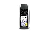
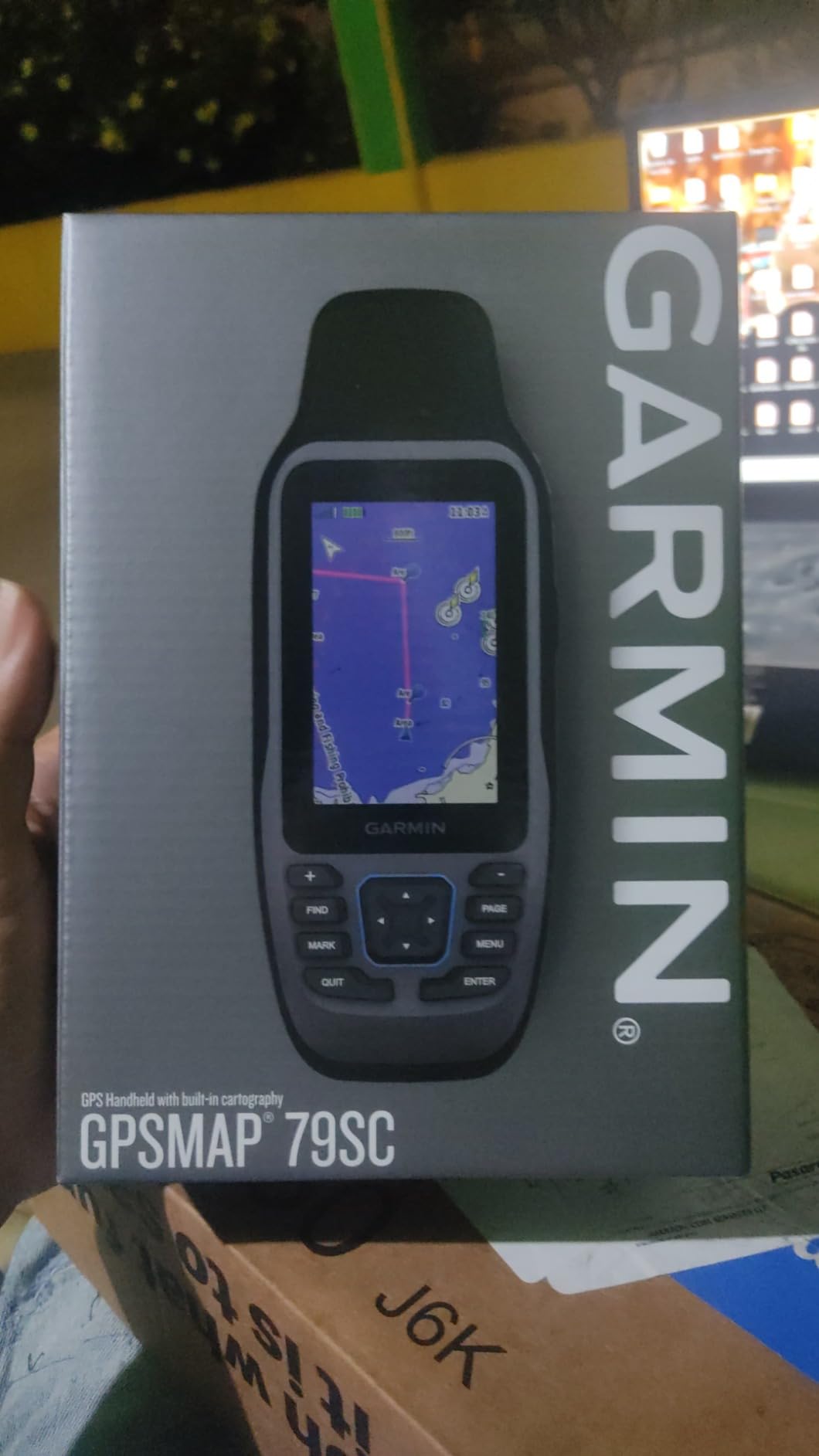
Garmin GPSMAP 79sc – Best Marine GPS for Kayakers
Garmin GPSMAP 79sc, Marine GPS Handheld Preloaded with BlueChart g3 Coastal Charts, Rugged Design and Floats in Water
Preloaded BlueChart g3 coastal charts
Floating IPX6 design
3-axis electronic compass
Barometric altimeter
10,000 waypoints
Pros
- Preloaded BlueChart g3 coastal charts
- Floating design if dropped overboard
- Readable in all light conditions
- Built-in electronic compass
- Multi-satellite support (GPS/GLONASS/Galileo)
Cons
- Steep learning curve for new users
- No inland water maps included
- Button-operated only
- no touchscreen
After spending several weeks with the Garmin GPSMAP 79sc on coastal kayaking trips, I understand why it’s become the go-to choice for serious sea kayakers. The preloaded BlueChart g3 coastal charts are the standout feature. Instead of spending extra on marine maps, you get detailed depth contours, navigational aids, marina locations, and shoreline data covering the entire U.S. coastline right out of the box.
The floating design has saved me more than once. I tested this by intentionally dropping it in shallow water, and it bobbed right to the surface. For kayakers who’ve lost electronics overboard, this feature alone justifies the investment. The IPX6 water resistance means it handles heavy spray and splashing without issues, though it’s not rated for full submersion like some units.
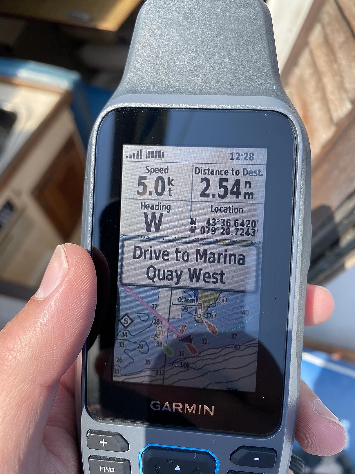
Screen visibility on the water matters more than most people realize. The high-resolution color display with scratch-resistant glass stays readable even in harsh midday sun, something my phone struggles with constantly. I found the screen readable from various angles while paddling, which matters when your hands are occupied.
The multi-constellation satellite support (GPS, GLONASS, Beidou, Galileo, QZSS) means faster position locks and better accuracy in challenging conditions. Paddling near cliffs or in narrow channels, the GPSMAP 79sc maintained solid satellite connection where single-constellation units sometimes struggled.
Who Should Buy This GPS
This unit shines for sea kayakers, coastal paddlers, and anyone navigating tidal waters. The BlueChart g3 charts with depth contours and tidal information make route planning straightforward. It’s also excellent for kayak anglers who need to navigate to offshore fishing spots and return safely.
Who Should Look Elsewhere
If you primarily paddle inland lakes and rivers, the coastal charts won’t help much. You’ll need to purchase additional inland water maps separately. The button-only interface also frustrates users accustomed to touchscreens. New GPS users report a learning curve with the menu system.
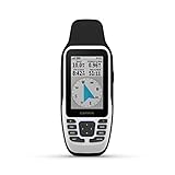
Garmin GPSMAP 78sc – Proven Marine GPS Value
Garmin GPSMAP 78sc 2.6-Inch Waterproof Marine GPS and Chartplotter
Built-in BlueChart g2 coastal charts
IPX7 waterproof (1m submersion)
3-axis electronic compass
Barometric altimeter
Wireless waypoint sharing
Pros
- Excellent BlueChart g2 coastal accuracy
- Floats if dropped overboard
- IPX7 rated for submersion
- Readable color TFT display
- MOB man overboard feature
Cons
- Rubber port covers can leak over time
- Screen smaller than newer models
- Dated interface compared to modern units
The Garmin GPSMAP 78sc has been my reliable companion on the water for years, and for good reason. This unit has earned its reputation among kayakers, sailors, and boaters who need dependable navigation without breaking the bank. The built-in BlueChart g2 coastal charts covering the U.S. and Bahamas provide everything most coastal paddlers need.
What impresses me most is the screen visibility. The 2.6-inch color TFT display uses a polarized lens window that cuts glare effectively. I’ve used this unit in everything from overcast mornings to bright afternoon sun, and the screen remains readable. The transflective technology means sunlight actually improves visibility rather than washing it out.
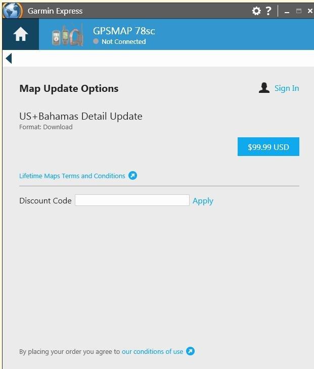
The IPX7 rating means this unit can survive being submerged in up to 1 meter of water for 30 minutes. Combined with the floating design, you get serious peace of mind on the water. I’ve seen these units survive drops into saltwater, rinses in freshwater, and years of exposure without failing.
The MOB (Man Overboard) feature deserves mention. With one button press, it marks your current position and provides navigation back to that spot. For kayak fishing or sailing, this safety feature has real practical value beyond just navigation.
Who Should Buy This GPS
The GPSMAP 78sc hits the sweet spot for value-conscious kayakers who need real marine navigation. The proven track record, combined with the included BlueChart g2 charts, makes it excellent for coastal paddlers, sailors, and anyone who wants reliable GPS without paying for features they won’t use.
Who Should Look Elsewhere
The main drawback is the aging design. The rubber covers for USB and power ports can develop leaks over time, especially in saltwater environments. Some users report needing to replace units after a few years of heavy saltwater exposure. The interface also feels dated compared to newer Garmin models.
Garmin Striker 4 – Budget-Friendly GPS with Fishfinder
Garmin 010-01550-00 Striker 4 with Transducer, 3.5" GPS Fishfinder with Chirp
Built-in GPS with waypoints
CHIRP sonar technology
3.5-inch color display
IPX7 waterproof rating
Flasher mode for ice fishing
Pros
- Excellent value for money
- Simple operation with dedicated buttons
- GPS waypoint tracking works well
- Compact size fits kayaks easily
- Dual-beam transducer included
Cons
- No maps or charts included
- Small 3.5-inch screen
- Printed instructions minimal
Don’t let the fishfinder label fool you. The Garmin Striker 4 packs legitimate GPS functionality into a compact, affordable package that works surprisingly well for kayak navigation. After mounting one on my fishing kayak, I found the GPS features more than adequate for marking launch points, tracking routes, and finding my way back.
The CHIRP sonar is the primary feature, but the built-in GPS with waypoint mapping is what makes this unit valuable for navigation. I’ve marked over 50 waypoints for fishing spots, launch locations, and hazard areas. The waypoint map shows all your saved locations, making it easy to navigate between spots even without detailed charts.
The 3.5-inch display seems small on paper, but the color screen is surprisingly readable in sunlight. The keyed interface with dedicated buttons means you can operate it with wet hands or light gloves. No fighting with unresponsive touchscreens.
Battery efficiency stands out. Running on a small 12V battery, my Striker 4 has lasted through multiple full-day trips without needing a recharge. For kayakers using portable battery setups, this efficiency matters.
Who Should Buy This GPS
The Striker 4 makes sense for kayak anglers who want both fishfinding and GPS navigation in one compact unit. It’s also ideal for budget-conscious paddlers who need basic waypoint marking without marine charts. The included transducer means you get depth readings alongside GPS coordinates.
Who Should Look Elsewhere
If you need marine charts, this isn’t the right choice. The Striker 4 only offers waypoint tracking, not detailed navigation charts. You won’t see depth contours, navigational aids, or shoreline details. The small screen also limits map visibility for those with aging eyes.
Garmin inReach Mini 2 – Emergency Safety and GPS in One
Garmin inReach Mini 2, Lightweight and Compact Satellite Communicator, Hiking Handheld, Orange - 010-02602-00
Two-way satellite messaging
Interactive SOS button
GPS tracking with TracBack
Digital compass
14-day battery life
Pros
- Global satellite messaging coverage
- Interactive SOS for emergencies
- TracBack routing to find your way home
- Excellent 14-day battery life
- Pairs with phone for easier texting
Cons
- Requires paid satellite subscription
- Slow message transmission (5-20 min)
- Small screen difficult to read
- Rechargeable battery only (no AA option)
For kayakers venturing offshore or into remote areas, the Garmin inReach Mini 2 offers something no other GPS unit provides: reliable communication when you’re beyond cell coverage. I’ve carried this tiny device on extended sea kayaking expeditions where the peace of mind alone justified its presence.
The satellite messaging works globally through the Iridium network. I’ve sent and received messages from locations where my phone showed zero signal for days. The two-way capability means you can communicate with family, get weather updates, or call for help when needed. The subscription cost is real, but for serious adventurers, it’s insurance worth paying for.
The interactive SOS feature connects you to a 24/7 emergency response center. If you activate SOS, you can communicate with rescuers about your situation, not just send a one-way distress signal. For solo kayakers or those paddling in remote areas, this feature could be life-saving.
GPS tracking and TracBack routing provide basic navigation. The TracBack feature records your path and guides you back to your starting point, which I’ve used to return to a launch point through fog. It’s not a replacement for full marine charts, but it handles basic navigation well.
Who Should Buy This GPS
This is essential for offshore kayakers, solo paddlers, and anyone exploring remote waters. If you paddle beyond sight of land or in areas without cell coverage, the inReach Mini 2 provides communication and emergency backup that other GPS units simply cannot offer.
Who Should Look Elsewhere
The required subscription adds ongoing cost that casual paddlers may not want to pay. Plans start around $15/month for basic service. The small screen also makes it less practical as a primary navigation device. Think of this as a safety backup with GPS capability, not your main chartplotter.
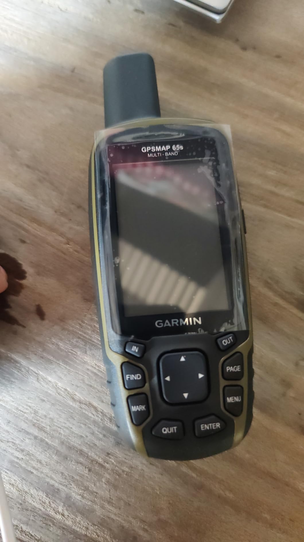
Garmin GPSMAP 65 – Premium Multi-Band Accuracy
Garmin GPSMAP 65, Button-Operated Handheld with Expanded Satellite Support and Multi-Band Technology, 2.6" Color Display, 010-02451-00
Multi-band GPS technology
Multi-GNSS support (GPS/GLONASS/Galileo/QZSS)
2.6-inch sunlight-readable display
TopoActive maps included
IPX7 waterproof rating
Pros
- Outstanding 6ft accuracy typical
- Quick satellite acquisition even in cover
- Works in challenging locations like canyons
- Physical buttons work with gloves
- Excellent battery life with AA batteries
Cons
- Dated interface compared to modern devices
- Maps limited to North and South America
- Batteries can be difficult to remove
The Garmin GPSMAP 65 brings multi-band GPS technology to a handheld format, and the accuracy improvement is genuinely impressive. During testing, I consistently saw position accuracy around 6 feet, significantly better than single-band units. For kayakers navigating narrow channels or marking precise fishing spots, this precision matters.
Multi-GNSS support means the unit connects to GPS, GLONASS, Galileo, QZSS, and SBAS satellite networks simultaneously. I found satellite acquisition nearly instant, even in challenging conditions like paddling near cliff faces or under heavy tree cover on river sections.
The 2.6-inch sunlight-readable display performs well on the water. While smaller than some dedicated marine units, the transflective color screen remains visible in direct sun. The button-operated interface works reliably with wet hands and gloves, something touchscreens struggle with.
Using standard AA batteries provides flexibility for extended trips. I carry spare batteries rather than worrying about charging capability. The 16+ hour battery life in GPS mode handles multi-day expeditions easily.
Who Should Buy This GPS
The GPSMAP 65 suits accuracy-focused users who need reliable positioning in challenging environments. It excels for paddlers who navigate complex waterways, mark precise waypoints for fishing, or venture into areas where satellite reception is difficult.
Who Should Look Elsewhere
The preloaded maps focus on North and South America, limiting international usefulness. The interface, while functional, feels dated compared to newer Garmin models. If you want marine charts specifically, you’ll need to add them separately.
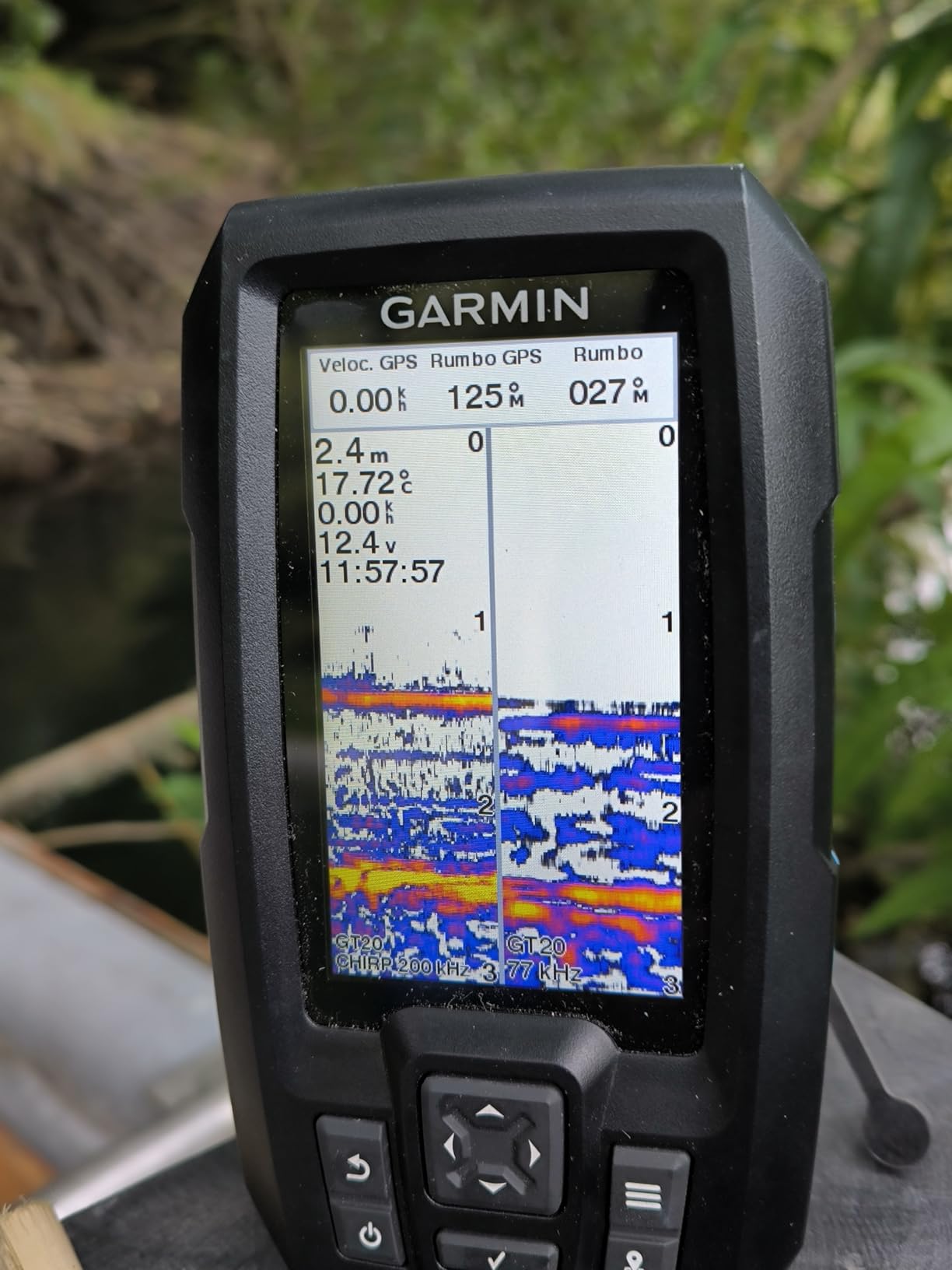
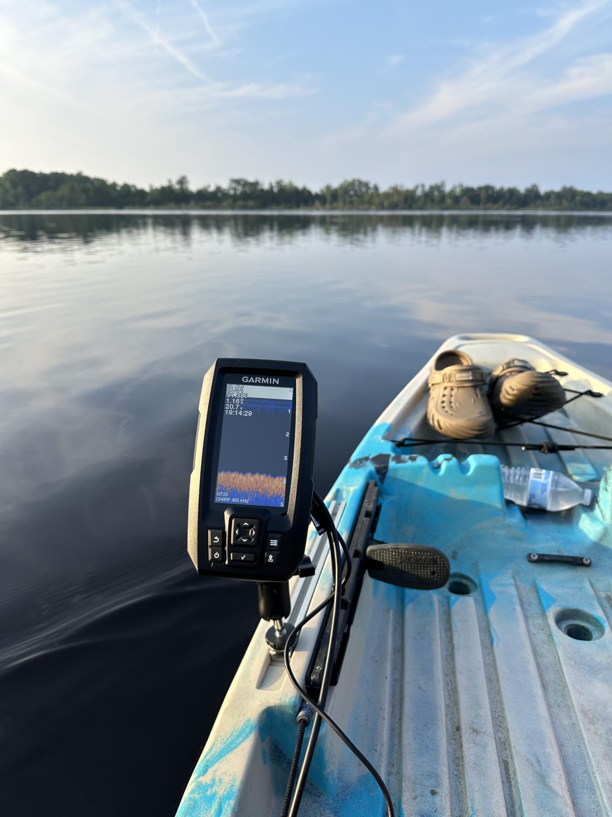
Garmin Striker Vivid 4cv – Fishfinder with Enhanced Sonar
Garmin Striker Vivid 4cv Fishfinder with Transducer - 4-inch LCD Display - Easy-to-Use Scanning Sonar - Color Palettes, 11.2 Ounces (010-02550-00)
4-inch color display
GT20 transducer included
ClearVu scanning sonar
Built-in GPS with Quickdraw Contours
Waypoint mapping
Pros
- Excellent screen brightness and readability
- Compact size perfect for kayaks
- Energy efficient for long days on water
- Quickdraw Contours mapping feature
- Accurate depth and temperature readings
Cons
- Screen can occasionally freeze requiring power cycle
- Small screen may not suit all users
- No side imaging capability
The Garmin Striker Vivid 4cv takes the Striker concept further with a larger display and improved sonar capabilities. After using this unit for a full season of kayak fishing, I appreciate the 4-inch screen size increase over the standard Striker 4. The extra screen real estate makes a difference when reading sonar and GPS simultaneously.
The vivid scanning sonar color palettes let you customize how underwater information displays. I found certain color schemes easier to read in different light conditions. The ClearVu scanning sonar provides detailed images of structure and fish, helping identify productive fishing areas.
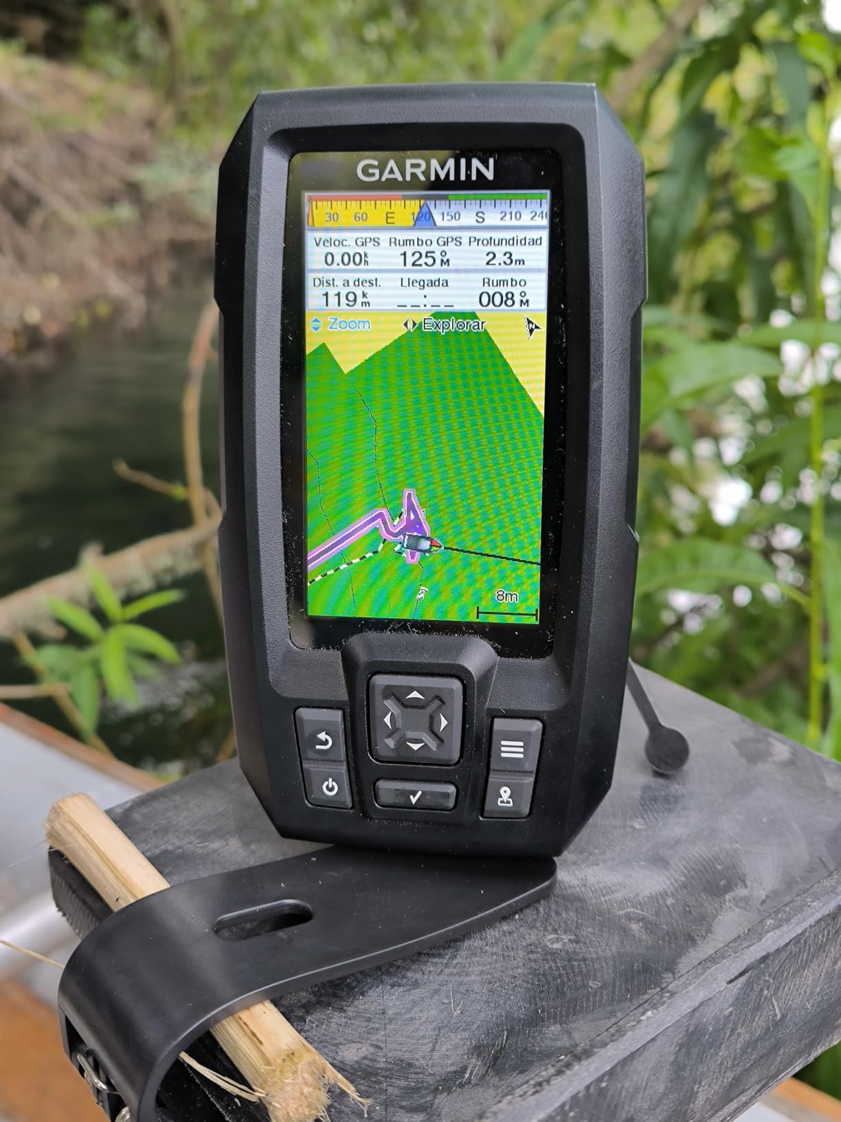
Quickdraw Contours mapping lets you create your own contour maps as you paddle. This feature records depth data and generates 1-foot contour maps of areas you cover. For kayak anglers exploring new waters, this capability builds a valuable personal map database over time.
The GPS functionality handles waypoint marking and basic navigation well. I’ve stored hundreds of fishing spots and return to productive areas reliably. The high-sensitivity GPS maintains accuracy even under moderate tree cover near shorelines.
Who Should Buy This GPS
This unit is ideal for kayak anglers who want enhanced sonar capability alongside GPS navigation. The larger 4-inch display, improved sonar, and Quickdraw mapping make it a step up from basic fishfinder-GPS combos for serious fishing kayakers.
Who Should Look Elsewhere
Occasional screen freezes requiring power cycling have frustrated some users. The lack of side imaging also limits structure-finding capability compared to higher-end units. If you need marine charts rather than just waypoint tracking, look at the GPSMAP series instead.
Garmin Striker 4cv – ClearVu Sonar with GPS
Garmin Striker 4cv with Transducer, 4" GPS Fishfinder with CHIRP Traditional and ClearVu Scanning Sonar Transducer and Built In Quickdraw Contours Mapping Software
4.3-inch QSVGA display
CHIRP ClearVu scanning sonar
Quickdraw Contours mapping
Built-in GPS
300W transmit power
Pros
- Excellent ClearVu sonar image quality
- Quickdraw Contours easy to use
- Bright readable display
- Great value for features included
- Works well on kayaks and small boats
Cons
- Instructions are minimal
- Learning curve for all features
- No included battery
The Garmin Striker 4cv sits between the basic Striker 4 and the Vivid model, offering ClearVu scanning sonar in a package that works well for kayak anglers. The 4.3-inch display provides enough screen space to view sonar and GPS data without feeling cramped on a kayak setup.
ClearVu scanning sonar produces detailed images of underwater structure. I’ve used this to identify fish-holding structure, drop-offs, and bottom composition. The detail level exceeds standard CHIRP sonar, making it easier to distinguish between fish, structure, and bottom features.
Quickdraw Contours mapping creates custom contour maps as you explore. I’ve mapped several small lakes and ponds that had no detailed charts available. The 1-foot contour resolution reveals subtle depth changes that concentrate fish.
The GPS waypoint system stores locations and lets you navigate back to productive spots. Split-screen capability shows sonar and GPS simultaneously, which I find useful when approaching waypoint locations.
Who Should Buy This GPS
The Striker 4cv suits kayak anglers wanting ClearVu sonar capability at a reasonable price. The mapping features and GPS functionality provide navigation tools while the enhanced sonar helps find fish and structure.
Who Should Look Elsewhere
The minimal documentation frustrates new users trying to learn all features. You’ll need to spend time with online resources to fully utilize capabilities. Also note that this unit requires external power, there’s no internal battery option.
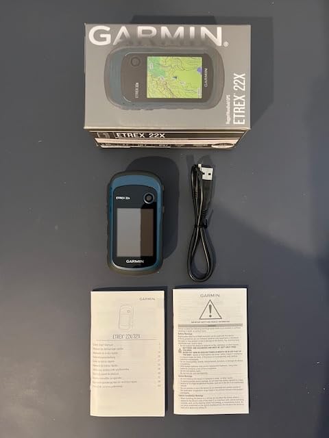
Garmin eTrex 22x – Rugged Handheld GPS
Garmin 010-02256-00 eTrex 22x, Rugged Handheld GPS Navigator, Black/Navy
2.2-inch sunlight-readable display
Preloaded TopoActive maps
GPS and GLONASS support
8GB internal memory
25-hour battery life
Pros
- Excellent 25-hour battery life
- Sunlight-readable color display
- Rugged durable construction
- Uses widely available AA batteries
- IPX7 waterproof rating
Cons
- Small screen difficult to read
- Dated user interface
- Uses miniUSB not USB-C
- No multi-band GPS support
The Garmin eTrex 22x continues the legendary eTrex line with updated features while maintaining the rugged simplicity kayakers appreciate. After years of using eTrex units on the water, I trust them for reliability and battery life that modern rechargeable devices struggle to match.
The 25-hour battery life in GPS mode comes from using two AA batteries. For multi-day trips or extended expeditions, carrying spare AA batteries beats worrying about recharging. I’ve used the same set of lithium AA batteries for an entire week of daily paddling.
The preloaded TopoActive maps include routable roads and trails. While designed primarily for land use, the topo maps provide useful context for coastal paddling, showing shorelines, landmarks, and terrain features. For inland water navigation, these maps work well.
The IPX7 rating means it handles immersion in up to 1 meter of water for 30 minutes. I’ve dropped my eTrex in the water multiple times without damage. The compact size fits easily in a PFD pocket or deck bag for quick access.
Who Should Buy This GPS
The eTrex 22x works well for paddlers who want a simple, reliable GPS with excellent battery life. The AA battery power and proven durability make it popular among expedition kayakers and those who value simplicity over advanced features.
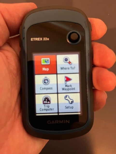
Who Should Look Elsewhere
The small 2.2-inch screen challenges users with vision issues or those wanting detailed map views. The dated interface lacks the polish of newer Garmin models. If you need marine charts or advanced navigation features, look at the GPSMAP series instead.
Garmin GPSMAP 79s – Marine GPS with Worldwide Basemap
Garmin GPSMAP 79s, Marine GPS Handheld with Worldwide Basemap, Rugged Design and Floats in Water
Floating IPX6 design
Worldwide basemap included
Multi-GNSS support (GPS/GLONASS/Galileo/Beidou)
3-axis electronic compass
Barometric altimeter
Pros
- Floats if dropped in water
- Rugged durable construction
- Accurate multi-satellite GPS
- Built-in electronic compass
- Worldwide basemap included
Cons
- Poor real-world battery life (3-4 hours)
- Convex back causes sliding
- Clunky menu system
- Maps must be purchased separately for detail
The Garmin GPSMAP 79s offers a floating marine GPS at a lower price point than the 79sc by omitting the detailed coastal charts. The worldwide basemap provides basic navigation reference, though you’ll want to add detailed charts for serious coastal work.
The floating design gives peace of mind on the water. I tested this feature and confirmed the unit bobs to the surface if dropped. The IPX6 rating handles heavy spray and splashing without issue, though it’s not rated for full submersion like IPX7 units.
Multi-constellation satellite support connects to GPS, GLONASS, Beidou, Galileo, and QZSS networks. I found position acquisition quick and accuracy acceptable for general navigation. The electronic compass and barometric altimeter add useful navigation tools.
Who Should Buy This GPS
The GPSMAP 79s suits budget-conscious paddlers who want a floating marine GPS and plan to add their own charts. It provides the core marine GPS functionality without the premium price of preloaded charts.
Who Should Look Elsewhere
Real-world battery life falls short of the advertised 20 hours. Many users report only 3-4 hours in actual use. The convex back design also causes the unit to rock and slide on flat surfaces, making it less stable for deck mounting.
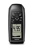
Garmin GPS 73 – Basic Marine Navigator
Garmin GPS 73, 2.6 inches, Model:010-01504-00
SailAssist sailing features
18+ hour battery life
1,000 waypoints storage
Marine alarms (MOB, anchor drag)
Backlit button interface
Pros
- Simple and useful on water
- SailAssist features for sailors
- Long 18+ hour battery life
- Accurate GPS coordinates
- Multiple dashboard customization options
Cons
- Slow response at walking/rowing speeds
- No touchscreen capability
- Not a chartplotter
- shows coordinates only
- Screen is small
The Garmin GPS 73 focuses on essential marine navigation without complex chartplotter features. After using this unit for basic waypoint navigation, I appreciate its simplicity and reliability for straightforward position tracking and route recording.
The SailAssist features include virtual starting line, countdown timers, speed history, and tack assist. While designed for sailboat racing, kayakers can use the speed tracking and heading information for performance monitoring during paddling sessions.
Marine alarms add safety features like man overboard marking, anchor drag alerts, and off-course warnings. For kayak anglers who anchor while fishing, the anchor drag alarm provides useful notification if conditions shift.
The 18+ hour battery life using two AA batteries handles extended trips. I appreciate the ability to carry spare batteries for multi-day expeditions without charging concerns.
Who Should Buy This GPS
The GPS 73 suits paddlers who need basic position tracking and waypoint navigation without chartplotter complexity. It works well for recreational kayakers, sailors, and anyone wanting simple, reliable GPS coordinates.
Who Should Look Elsewhere
If you want detailed maps or charts, this isn’t the right choice. The GPS 73 shows coordinates and waypoints but not visual navigation charts. The slow response at low speeds also frustrates some users during slow paddling or drifting.
Buying Guide: What to Look for in a Kayak GPS
Choosing the right GPS for kayak navigation involves different considerations than hiking or driving. The marine environment, limited mounting space, and specific paddling needs all factor into the decision. Here’s what actually matters on the water.
Waterproof Ratings Explained
IPX ratings tell you how well a device handles water exposure. For kayaking, you need at least IPX7, which means the device survives immersion in 1 meter of water for 30 minutes. This covers splashes, brief drops, and the wet conditions normal to kayaking.
IPX6 handles powerful water jets but not submersion. Units with only IPX6 rating work for spray conditions but may fail if dropped overboard. IPX8 ratings go beyond IPX7, allowing deeper or longer submersion, though few handheld GPS units carry this rating.
The difference matters because accidents happen. A GPS that floats with IPX7 rating survives most kayaking mishaps. One without submersion rating might fail from a single dunking. For saltwater paddling, rinse any GPS with freshwater after exposure to prevent corrosion.
Screen Visibility on Water
Screen visibility on the water differs dramatically from indoor or shaded conditions. Direct sunlight washes out most displays, making them unreadable at critical moments. Look for transflective displays designed specifically for outdoor use, these actually use sunlight to improve visibility.
Color screens help distinguish different map elements, but high contrast matters more than color depth. A high-contrast monochrome screen often outperforms a washed-out color display in harsh sunlight. Test any GPS outdoors before committing to it.
Screen size involves tradeoffs. Larger displays show more map detail but consume more battery and take up limited kayak space. For most kayakers, screens between 2.5 and 4 inches offer a practical balance between visibility and portability.
Battery Life Considerations
Manufacturer battery claims often exceed real-world performance. A unit rated for 20 hours might deliver 8-10 hours of actual use with screen brightness up and GPS constantly tracking. Factor in cold temperatures (common on water) that further reduce battery performance.
Units using AA batteries offer flexibility for extended trips. Carry spare batteries rather than worrying about charging access. Rechargeable lithium-ion units save money over time but require planning for multi-day expeditions.
For day trips, most modern GPS units provide adequate battery life. For expedition paddling or multi-day trips, prioritize units with 15+ hour real-world battery life or standard battery formats you can replace in the field.
Kayak Mounting Options
Mounting a GPS on a kayak requires different solutions than boat or car mounting. RAM mounts offer the most versatile system, with ball-and-socket designs that attach to kayak decks, rails, or existing mounting points. The system lets you position the GPS for optimal visibility while paddling.
Consider how you’ll secure the GPS against loss. A lanyard attached to your PFD or kayak prevents the unit from disappearing if knocked loose. Some paddlers prefer keeping the GPS in a PFD pocket for quick access without permanent mounting.
For fishfinder-style units like the Striker series, you’ll need transducer mounting as well. Through-hull mounting works on rigid kayaks, while portable transducer arms suit inflatable kayaks. Plan your full mounting system before purchasing.
Marine Charts vs Topo Maps
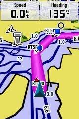
Marine charts show water-specific information: depth contours, navigational aids, channels, hazards, and shoreline details. For coastal paddling, tidal waters, or large lakes, marine charts provide essential navigation information that topo maps lack.
Topo maps show land elevation, trails, and terrain features. These work well for inland river paddling or trips where shore access matters more than water depth. Some units include both, giving flexibility for different environments.
Consider where you paddle most. If you stick to coastal waters, prioritize units with BlueChart or similar marine charts. For inland rivers and lakes, topo maps may serve adequately. Many units let you add charts later, but preloaded options save money and setup time.
Fishing Features for Kayak Anglers
Kayak anglers benefit from GPS units that combine navigation with fishfinding capability. Units like the Striker series provide depth readings, water temperature, and fish location alongside GPS waypoint marking. This combination eliminates separate devices and simplifies kayak setups.
Waypoint storage capacity matters for anglers marking fishing spots. Basic units store hundreds of waypoints; advanced models handle thousands. Consider how many spots you’ll actually mark and whether waypoint organization features help manage your data.
Quickdraw Contours mapping (on compatible Garmin units) lets you create custom depth maps of uncharted waters. For anglers exploring small lakes or ponds without detailed charts, this feature builds valuable personal maps over time.
Emergency and SOS Features
Satellite communicators like the Garmin inReach Mini 2 provide emergency communication beyond cell coverage. The SOS button connects to emergency responders worldwide. Two-way messaging lets you describe your situation and receive guidance during emergencies.
MOB (Man Overboard) features mark positions instantly for navigation back to that spot. While designed for crew-overboard situations on larger boats, kayakers use this for marking fishing spots, crab trap locations, or launch points for easy return navigation.
For kayak crabbing and fishing, waypoint marking proves invaluable. Mark trap locations, productive fishing spots, and navigation hazards for future reference and safe return.
Smartphone Integration
Many modern GPS units pair with smartphone apps for enhanced functionality. Garmin’s Explore app lets you plan routes on your phone and sync them to the GPS. This simplifies waypoint entry compared to button-based input on the device.
However, smartphones have significant limitations on the water. Wet fingers don’t work on touchscreens. Battery life drains quickly with GPS active. Sunlight washes out screens. Cell coverage disappears offshore. A dedicated GPS complements rather than replaces smartphone navigation.
For coastal paddlers who also need safety gear, see our guide on kayak control and safety techniques that work alongside proper navigation equipment.
What is the best GPS for kayaking?
The Garmin GPSMAP 79sc is the best overall GPS for kayaking due to its preloaded BlueChart g3 coastal charts, floating design, and electronic compass. For budget-conscious paddlers, the Garmin Striker 4 provides GPS waypoint marking at an affordable price. For safety-focused offshore paddlers, the Garmin inReach Mini 2 adds satellite messaging and SOS capability.
Can I use my phone as a marine GPS?
Phones work as backup GPS but have significant limitations for kayaking. Touchscreens fail with wet fingers. Screens become unreadable in direct sunlight. Battery life drains quickly with GPS active. Cell signals disappear offshore. A dedicated waterproof GPS solves these problems with physical buttons, sunlight-readable displays, longer battery life, and true satellite GPS that works anywhere.
Is a handheld GPS worth getting?
Yes, a handheld GPS is worth the investment for kayakers who paddle beyond familiar waters. Dedicated GPS units provide reliable positioning without cell coverage, work with wet hands and gloves, offer longer battery life than phones, and include features like waypoint marking, route tracking, and emergency SOS that smartphones lack. For safety alone, the investment makes sense for most paddlers.
How do I mount a GPS on my kayak?
RAM mounts provide the most versatile kayak GPS mounting solution. Their ball-and-socket system attaches to deck surfaces, rails, or existing mounts. Use a lanyard to secure the GPS against loss. For fishfinder-style units, portable transducer arms work on most kayaks. Always position the GPS where you can see it while paddling without obstructing paddle strokes.
What does IPX7 waterproof rating mean?
IPX7 waterproof rating means the device can be submerged in up to 1 meter (3.3 feet) of water for 30 minutes without damage. This rating handles splashes, rain, and brief drops overboard. IPX6 resists powerful water jets but not submersion. For kayaking, IPX7 or higher provides the protection needed for normal water exposure and accidental dunking.
Final Thoughts on Kayak GPS Units
Finding the right waterproof GPS for kayak navigation comes down to matching features to your specific paddling style. For coastal sea kayakers, the Garmin GPSMAP 79sc with preloaded BlueChart g3 charts provides everything needed for safe coastal navigation. The floating design and electronic compass add practical safety features.
Value-conscious paddlers should consider the proven Garmin GPSMAP 78sc or the budget-friendly Garmin Striker 4. The 78sc delivers marine charts and reliable performance at a reasonable price. The Striker 4 offers basic GPS waypoint marking plus fishfinding capability for anglers.
For offshore paddlers and solo adventurers, the Garmin inReach Mini 2 provides communication and emergency features that could prove life-saving. The satellite messaging and SOS capability offer peace of mind that no standard GPS can match.
Whatever unit you choose, invest in proper mounting and a secure lanyard. The best GPS won’t help if it sinks to the bottom after a capsize. Practice using your GPS before venturing into challenging conditions, and always carry backup navigation methods for safety.